I finally got up around 7:30, hit the continental breakfast, and my wife called at 7:45 saying that they were leaving Baton Rouge. I had 4 hours to ride. Should be plenty of time.
The last time I was at Bonita Lakes was in 1999. Back then, the trail started at the dam between the North Lake...
...and the South Lake.
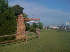
Today there is pavement leading across the dam and a very nice-looking trailhead, complete with a map.
I strained to remember whether there was pavement across the dam ten years ago or not. It seemed like there wasn't, but the more I thought about it, I couldn't really be sure. Funny how you forget things. I did remember that there were random trails going everywhere, me and Kirk got lost all day and probably rode the same loops 50 times.
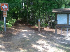
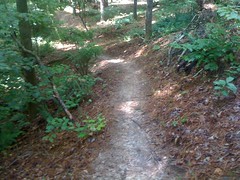
Today it was a little better. But only a little. With my GPS, I was able to decipher the maze, but I could never ride for very long before coming to another 5-way intersection. The trails themselves were pretty nice. Mostly flowing sidehill, with just enough chunky fall-liners to keep it interesting. The tread was pine-needly, packed sand and crumbly rock. Reminded me of Big Creek in the ATL.
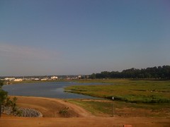
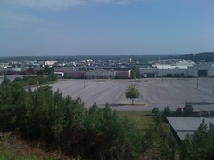
If I'd known a route through it, it would have been really fun. I remembered this overlook from '99. They were still building the mall back then.
After thoroughly exploring the first little section of singletrack, I took the "improved trail" around the park.
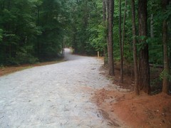
Ten years ago it was a rutted out fire road. The signs along the trail show it to be a hiking trail, but the map says it's open to bikes as well, and there are several bike trails you can't get to without riding it. I even passed a park ranger in his truck, heading the other way. He just waved. I guess it's open to bikes.
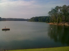
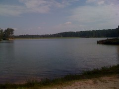
The improved trail was scenic, running along, or crossing the South Lake at several points.
After a big loop around the park, I explored more singletrack. The trails further into the park were less of a maze and more fun to ride. I ended up using all my time, but I have a feeling that I only rode about half of the trails out there.
It was hot too, or at least it felt really hot. I drank all I could, but it still wasn't enough. After meeting my family at the Cracker Barrell, I chugged 2 mugs of lemonade and gave myself some world class heartburn.
I end up in Meridian about twice a year, retrieving my family, so I imagine I'll have plenty more opportunities to learn the trails. Maybe next time I can spend some time just riding them.


No comments:
Post a Comment