I've been feeling pretty bad lately. No energy, tired muscles. I figured I just needed rest and a break from the bike. This morning I slept in until I couldn't sleep anymore, which ended up being about 11:30, and no bike today, just feet.
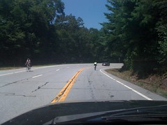
I wasn't riding, but plenty of other folks were, all up in the Gaps. Some struggling. Stay strong guys. I feel your pain.
To get to Bowers Cove, you have to go through a neighborhood. At the time, I couldn't remember which, but then I saw Bowers Road. That might be it.
Last time I was up there, I drove out to the end of FS298, but skipped 395. Today I drove out to the end of it too. It was bumpy and overgrown. I haven't done much 4WD in a while. Fun stuff.
But enough screwing around. Topo's show 3 trails in the area. All three lead up to Duncan Ridge from down in the cove. I would hike them. I parked out at the end of 298 and walked around the campground a bit. Two dudes were panning for gold in the creek. Seriously. Kinda looked like fun actually.
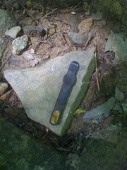
But, again, enough screwing around. I took off up along Roaring Fork. The trail was there, just like the map said. And a pretty good trail too. Old roadbed, not too overgrown, lots of creek crossings. The first one was this cool loggy ford.
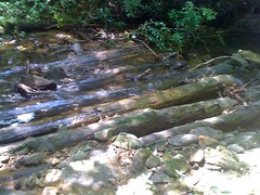
I'd heard of those before, but never seen one. It is alleged that Mountaintown used to have lots of them, but over the years, the logs rotted or floated away.
Another ford.
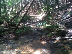
There were like twenty of them.
Near the top, there was a spur leading off to the east. The map showed the main trail going that way, but the trail-most-travelled headed south. I went south. At the top it tee'd into a road. Not like an old roadbed-turned trail, but an actual, I-could-drive-my-truck-on-it-if-it-were-open road. One not on the map though. I figured it would join up with FS108 at Bull Gap if I headed east, so I headed east.
My phone rang. How did I even have service? I just bring it with me to take pictures. Eddie O was out scouting the TNGA and had some questions about the Pinhoti. It was weird that he had service too.
The road led to FS108 just where I thought it would. Apparently 108 just used to keep going, but now it's blocked off big time. Dirt, humps, giant rocks, staggered along the trail.
I backtracked and followed the old road the other way. It was flattish and clean for a while, then it turned hard left up a super steep ridge and got crazy rutted and nasty for a really short little bit, then it was clean again. Somebody didn't think ahead when they built that road. Maybe that's why it was closed. But why all the way back at Bull Gap? Later I'd discover that there's apparently some kind of Bowers Cove/Coosa Creek Ecosystem Project going on. Maybe they're trying to exclude all vehicular traffic from the headwaters of the East Branch of Coosa Creek. Who knows though.
There was an ton of striped maple up there.
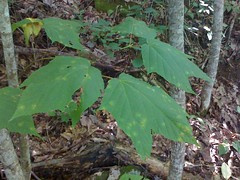
Not that rare of a tree, but still, surprisingly abundant up there.
Apparently somebody rides bikes on this trail too.
Millipede.
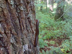
These things are all over North Georgia. There's like one every 10 feet.
The trail crossed the Duncan Ridge trail and tee'd into Duncan Ridge Road. I took the trail west.
Check out this sign.
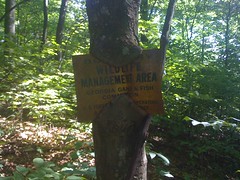
It's like the tree's eating it.
The map shows a 4WD road leading down from some unnamed gap to Jones Branch, then up over Jones Gap and back to where I was parked. It also showed a shortcut leading down along East Branch too.
I found the old road, found the shortcut and debated which way to go. It wasn't that late, I wasn't that tired, but it looked like a long trail. Five miles or more. I definitely wanted to check out the shortcut trail. Eventually I convinced myself not to be lazy and go for the long loop.
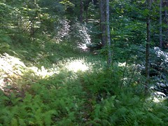
At first it was fine, then it got a little ferny.
Then it led up a draw and disappeared into nothing. I looked where the map said the trail should be. There was no old roadbed or anything like it. It kind-of, sort-of looked like there was maybe a trail there, but it was indistinct, and I was in no mood to follow anything indistinct, not when there's a clear trail back the other way.
My guess is that there's an old road leading up from the other way that ends near there and people just sidehill till they hit the creek and pick up the other old road. Maybe. I've done that before.
Not today though. I just went back and took the shortcut, which was a great trail. Reminded me of Lovinggood. Almost exactly like it. Maybe a little steeper.
At the bottom, it tee'd into the road I'd driven in on. Not exactly though. Same road, but I parked out at the end by a gate. Past the gate, the road used to keep going, but now it's a grass track, and marked foot traffic only.
From there back to the truck was long, flat and boring. There was this cool thing though.

An orb weaving spider (I think) had caught a butterfly and was chowing right down. Never seen that before. I got all close to take the picture, but the spider was all "dude, I got no time for you, look at this feast right here."
Right near the truck, there was this sign.
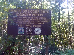
Which maybe explained why the roads were all closed. Not much info on the sign though, and I can't find anything on the net about it. A mystery.
So, I'd forgone the bike, thinking I was just burned out on it. But hiking sucked too. No energy, sore muscles. Maybe I've got a cold or allergies or something. Terrible.
I drove back a different way, by Helton Creek Falls, drove around on a bunch of roads over there that I've never been on before and found some more 4WD fun. One of the roads looked like it might lead over to Hogpen, but there was a big rock I couldn't get over without collecting and stacking up a bunch of other rocks, and man, it just wasn't worth it.
I did drive back up over Hogpen and into Helen for dinner. I called Clark, but they'd just finished eating so I was dining solo. Chile Colorado del La Cabana. Muy delicioso.
Tomorrow I'm going to take it easier than today.


No comments:
Post a Comment