Man, I hope this works, I'm attempting to use a Blogger app on my phone for this post. And I have doubts about it's abilities. I guess we'll see...
After a few tough days at work, we triumphed over the twin foes of obscurity and obsolescence and I finally got the good night's sleep I'd been hoping to get all week. This was good because I had a long day ahead of me.
I'd missed Karlos in Pisgah already. He and his crew had been up there all week. I'd meant to meet them up there but fate had other plans. Luckily, though, as I'd brought my bike with me, just in case, I would not be denied adventure, entirely.
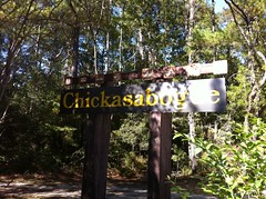
It was useless to attempt a direct return to Atlanta, I had a 4-hour race in Albany on Saturday. It made way more sense to drive to Albany, shack up there, race, and return to the ATL on that night or on Sunday. AND directly between New Orleans and Albany lies the bustling metropolis of Mobile and it's premier mountain bike destination: Chickasabogue.
The last time I'd ridden there had to be 10 years ago. At least. I'd heard they'd built more trail out there since then, but honestly I didn't even remember the old trail so really, it was all new to me.
The one thing I did remember was sand. Lots of loose, shifty sand. As it turned out though, those memories were only half-accurate. There were a few loose, sandy sections:
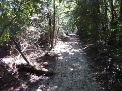
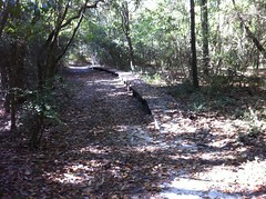
But mostly it was packed, duff-covered and grippy. I'm sure the soil has s high sand content, but you don't really notice it, most of the time.
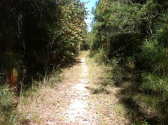
The trails out there are about 70% pure singletrack. The rest are either doubletrack or thin little ribbons on old roadbeds.
The diversity was satisfying.
But I'm getting ahead if myself.
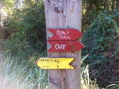
When I first rode out of the lot, I hung a left, crossed the road and aimed for some singletrack, only to stop short, fairly confused at the signage posted there. Something about red and yellow markers... From the deep recesses of my brain, I recalled some vague idea about one loop being marked yellow and the other marked red. But those were all false memories. It turns out that if you're on bike, you follow the red blazes and if you're on foot, you follow the yellow. The trees are marked on opposite sides. Bikes go counterclockwise.
The blazes ahead were yellow though and it took a minute for me to locate the red ones. However, if I'd been slightly more observant earlier, I might have noticed the big sign indicating the start of the loop, directly in front of my car.
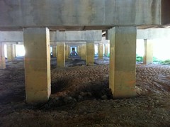
First, I rode the Cemetery Loop, then hung a right out under the I-65 bridge over to the east side of the park.
The trails on that side seemed newer and flowed better.
There wasn't much elevation change overall, but the trails wound around through the trees and made good use of what was available.
I'm not sure I'd put some of the trails on the IMBA how-to page but the tread appeared to be pretty well protected by pine needle kevlar and moderate traffic. I saw tire tracks when I was out there but there was only one other car in the lot all day.
Growing up on the Gulf Coast, the woods was familiar. There was a lot of pine, live oak, water oak and cypress. The brush was all some kind of extra tough autumn olive, or at least that's what it looked like. Good lord it was tough. Don't even try pushing through that crap, it'll stab your face off.
I did see two wonderful things though. The first was spanish moss. I forget all about spanish moss, and then I see it and it transports me back to my childhood, specifically to the front playground of Goodwood Elementary. The second was longleaf pine:
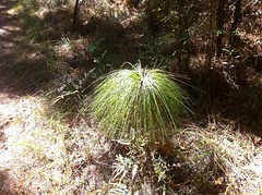
Allegedly, way back, it dominated the southeast, up through Georgia and North Carolina. It's long gone from the mountains now but you wouldn't know that from riding around Chickasabogue. It's not everywhere, but there's a noticeable amount.
I saw a turtle on the South Trail. I'm not sure what kind. Maybe it's a gopher tortoise. I don't know turtles.
That and one deer comprised my wildlife experience that day. I didn't even see any snakes. I know it's fall, but I figured I'd see at least one snake.
On the east side of the park, the trails were build as loops off of other loops. The second to last loop was the Black Forest Loop, or the Buck Forest Loop as I first read, or the Black Forert loop as the hike-direction sign indicated.
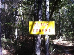
I want to know exactly how that happened. I mean, they stenciled the letters, then went around them again with a border and then went and hung the sign. I can't imagine that the misspelling went unnoticed at all three opportunities. Somebody had to have realized and just said screw it. Or maybe some kids made the signs, or maybe there's some other story. The misspelling certainly adds to the charm.
I took a little side trail near the Black Forest intersection and discovered some bluffs that had apparently once been ridden and abandoned long ago. All that remained of a trail through them was this feeble, hopelessly overwhelmed water bar.
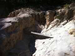
The noble fellow never gave up his post.
The Cypress Beach trail led to, as you might expect, Cypress Beach.
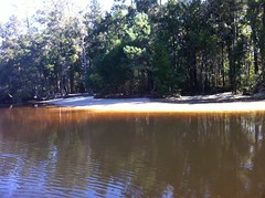
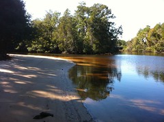
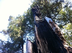
There was a gnarly old burned up tree right at the edge of the water.
I assume that the water is the Chickasabogue river. I think Bogue even means river. There are also Bogue Chitto and Bogue Falaya rivers in Mississippi and Louisiana had some Bogues too.
Almost all of the trails out there are well marked.
There are one or two exceptions, especially where the Beach and Indian Loops come together. I spent like 10 minutes trying to find a section there that's marked in the map but didn't appear to exist. It turned out that it was marked yellow (hike) but that if you go about 20 yards you start seeing red blazes.
Back on the west side of the park, I picked up some of the older trails again. Many of them lay on old roads, which apparently hold water in the winter. In the mountains, we'd reroute or build rock causeways but neither of those are options in southern Alabama so they build long bridges, wrapped in chicken wire. The chicken wire is impressively grippy. I know some bridges in North Georgia that could sure use some chicken wire.
Way out in the absolute middle of nowhere, there was this hand-powered water fountain, pump-thing.
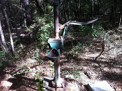
And it worked. Though you'd be out of luck trying to fill a bottle. You might be able to fill a dog bowl from the drain, or maybe a water bladder.
Throughout the park there were all these wooden half-barricades, chucked off to the side.
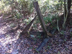
They were odd and I remembered them from 10 years ago. Back then, they had them set up across various parts if the trail to route traffic away from closed sections or off of roads. None were in use that day.
The last bit of trail on that side was a little confusing and I ended up riding through what I thought at first was some dude's yard. It turned out not to be but it made me a little nervous at first.
I'd ridden for about 4 hours but I wasn't 100% sure that I'd hit everything. I didn't, for example, remember seeing a beach on the Beach Trail, so I spun down to the front gate to see if they had an official map of the place. It turned out that they did, but before I got there and discovered that, I got distracted by a shiny white cube off to my left.
The cube turned out to be a windowless building that had been a church and a school in former lives, but was now some sort of local history museum.
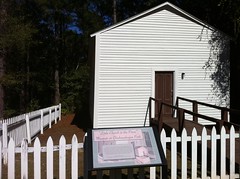
I'm generally a sucker for attractions like that but the day was kind of wearing on so I left it for next time.
That map that I mentioned scoring earlier revealed that I had, in fact, missed a bit. One section was sort-of difficult to find but led out to this beach which had apparently been Peterson's Landing, some time ago, or so I gathered from a modest little yellow sign on a gate nearby.
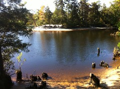
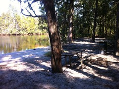
The other sections that I'd missed was easy to find. I'm not really sure how I missed them. Two of them led out to camping areas along the river similar to the one above.
One had these berries growing all over. Serviceberries?
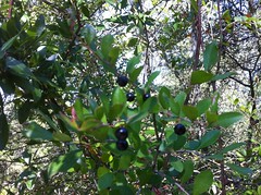
They tasted good but I didn't eat them. Until I can positively identify laurel cherries, I'm scared of anything purple and cherryish.
And so ended The Great Exploration of Chickasabogue. I spun a loop around on the paved roads to be sure I hadn't missed anything. It didn't appear that I had, so I packed it in and called it a day.
Later I discovered that I should have looked a little harder. There's apparently a cemetery out there that I didn't see. I should have expected as much, given that the name of one of the loops is the Cemetery Loop. I'm a genius.
Earlier, I'd discovered that the little building at the front gate was also a camp store so I stopped by on my way out for an Alabama Dr. Pepper.
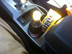
Alabama!
I think it was about 5 when I split. The Alabama DP was good but it wasn't exactly filling so I went scrounging around downtown Mobile for an actual meal.
There are shipyards all around Mobile. I saw a submarine sticking out of a warehouse and a half-built cruise ship moored in the river. They must make them mostly out of aluminum or something because it was blindingly shiny. I almost couldn't look at it.
Downtown Mobile is exactly like downtown New Orleans, if you removed the people and toned it down two notches. The architecture is the same, there are a bunch of streets with the same names, and if the place I are at is any indication, the food is good too.
I ended up at a place called Hophacks which bills itself as a pizza kitchen and taproom, but I think that should be reversed. It's really a bar where they serve pizza, but oh, what amazing pizza it was. I had their Butcher Block pizza which is topped with pepperoni, bacon and little bits of filet mignon. My god, it was good. You should eat it if you're in town, for certain.
So that was it for Chickasabogue and Mobile. I rolled east through the tunnel and past the USS Alabama with its giganticness. I need to take a tour of that one day, but I couldn't that day. Albany was still a few hours away and I had a race to get to.
Next time.


No comments:
Post a Comment