Oh man, I've got a backlog. Too many adventures in too short a time. I'd better get to more writing or less exploring. One or the other.
After a miserable failure last Thursday I went back to the Oliver Branch area Friday evening and made non-stop discoveries until and even after dark. One was so significant that it felt like discovering the northwest passage. That was literally the first analogy that came to mind when I found it. I've been reading a lot of Jules Verne lately.
Apparently there's an old road that runs along the ridge to the south of Oliver Branch. It eventually peters out but there's a "trail" along the ridge too that leads up to good old "89".
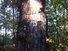
I'd been up there from several different directions before but never this one. It's a neat little place.
I still want to know who numbered it 89 though, and why. There's a 59 at FS42 and 42A too. Mysteries.
I long imagined there might be a route in the general direction of the one I took but every time I looked in the past, I just found old overgrown logging roads. This time though, it was the northwest passage.
On the way back down I discovered a shoe.
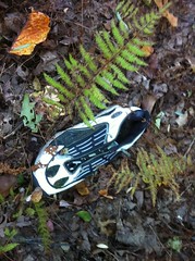
It was a really old-school running shoe. An animal had eaten the soft part out of the sole. The weirdest part is that I'd seen the other shoe of the pair earlier in the day, torn to shreds and 3/4ths embedded in the ground about a mile and a half away. How it is that someone came to lose both of their old-school running shoes in the absolute middle of nowhere is another mystery. The first shoe was so deteriorated that I'd left it alone. This one though, I packed out.
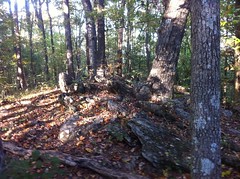
The woods is full of old cables. This one appears to have once been strung between two trees on the other side of an old ford on Oliver Creek.
I'd bet that in years past there were properties all up and down FS69 like there are along Conasauga Road today. The area beyond the cable is wide open too, with big trees, like maybe it had never been logged. I can only imagine an entire forest like that.
As cool as it was to find a route up to 89, it wasn't really what I was hoping to find.
Ages ago I'd walked out past the end of FS251 for a while but I was a less accomplished explorer back then and didn't venture too far. There appeared to be a maze of old roads back there though and if you look at the topography, it just really seems like one of them ought to drop down to FS69. So far though, I'd found nothing leading up there from below.
I had one last unexplored little spur on my map though. It looked promising but it didn't work out as well as it looked like it might. It led in the right direction but eventually became very overgrown after first becoming so steep that I can't imagine anyone ever driving anything on it. Clearly they must have though.
The view down into the valley was beautiful.
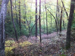
It's trying really hard to be fall.
I looked around and it was clear that people head up the old road then take a left up the adjacent hillside. I thought the old road had been steep but the hillside made it look like nothing. It was hands and feet all the way up. I assume the route is used by Rangers, with their 60 pound packs and unlimited hardness. I struggled with my little camelback. At the top it teed into a maze of old logging roads which eventually led to the end of FS251. Surely the one that used to be the continuation of 251 would go somewhere, right? Nope. It was mostly clear but right before it led into the Mill Creek valley it became highly overgrown. I always wonder how that happens. Did I miss a turn that most people take? Do hunters just walk out, set up in a tree stand all day and walk back? Is it just open as much as it is because of explorers like me? I always wonder.
I'd wagered daylight on Old 251 leading somewhere and when it didn't pay out, I was stuck with two pockets full of dark. Fortunately the moon was full, and for a while I had enough light to sort-of see by. I didn't really want to descend that hillside I'd climbed earlier though so I took another old road down. As fate would have it, it ended up going exactly where I'd hoped Old 251 would go. It was truly dark though. The hillside even hid the moon. I don't know whether to classify the trail as reclaimed or not. It felt overgrown, but in the dark, anything but the clearest trail does. Somewhere near the bottom I lost the path. It had either ended or turned abruptly. After a short bushwhack I found Rock Creek though, and in a rare stroke of good luck, I hit it right where a bunch of trees had fallen across. I didn't even get my feet wet.
In the moonlight, the road was as clear as day and I got back to my car quickly. Some people were setting up camp nearby and seemed somewhat surprised to see me walking by in the dark.
All right. Now that's what I'm talking about. Much better than Thursday. Still though, I'd hoped to be able to eliminate a bunch of little dotted lines from my map but in the end I think I actually added some. Isn't that how it always is though?


No comments:
Post a Comment