Sunday, August 30, 2015

Bear Den Creek

There might be a "real" Bear Den Creek in the Chattahoochee NF. The name seems familiar, at least. Maybe I'm thinking Bearden Creek, without the space. At any rate, neither of those are the one I'm talking about here. Today I paid a visit to the obscure Bear Den Creek across the highway from the Raven Cliffs Trail. The USGS maps show trails in the area. The lidar data looked interestng too, now that I kind-of know what I'm looking at.

Seemed like a good place to go.

I parked at the Raven Cliffs Lot and actually started off on the Raven Cliffs Trail.
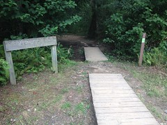
Raven Cliffs Trail

But I only took it as far as the northern edge of the first set of campsites. It's there that the trail tees into the old Byrd-Matthews railbed, hangs a left, and runs all the way up along Dodd Creek. I didn't do that though. I hung a right and followed the railbed in that direction.

It looked like that might have actually been the "correct" way to go at some point. It led right to the highway, and the kick up to the road was even paved. I guess, way, way back, people parked along the road and got on the trail there. There were what appeared to be old campsites over there too. There are no-parking signs at the road now though, and it looks like nobody's camped there in quite a while.

Across the Highway, a dirt road led east along Bear Den Creek. That's where I really wanted to go, but I figured the Old Raven Cliffs Trail might get me there, and fortunately it did.

There was a guy parked there, setting up camp below the road. His dog looked at me suspiciously and was like: "Yeah, stay up there buddy." Upon seeing me, the guy ran over and grabbed the dog. It seemed that he'd forgotten whether he'd tied it up or not. He had though, so no problem there. We ended up just exchanging waves and greetings and I kept moving.

I figured the road would be old and abandoned, but it was far from it.
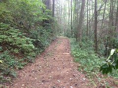
Bear Den Creek Food Plot Road

I soon discovered why. A cute little meadow lay at the northern end, still maintained by the Forest Service as a food plot, and the road provided access to it.

At the far end of the field a trail continued up along Bear Den Creek. The map made it look like Little Low Gap creek teed in somewhere around there too, and showed a trail leading up along it as well, but I didn't see it anywhere, and this trail looked really inviting.
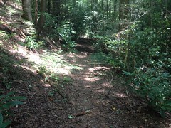
Bear Den Creek Trail

I figured I'd see where it went and double back for Little Low Gap later.

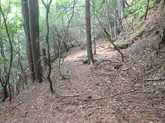
The trail was fairly well traveled, and it had the same general feel to it as Raven Cliffs. Judging by it's location, width, consistent grade, it seemed to be an old railbed, and by the looks of it, one that had never been converted into a road. It took a while though, before I found any definitive evidence.

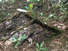
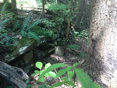
The few feeder creeks were small and they all just ran directly across the trail. If there'd ever been any drainage structures in place, they've long since been filled in or washed out. I did eventually find one significant feeder, with a vacuous gap that must have been spanned by a trestle at one point.

Both sides were fortified with stacked stone too.
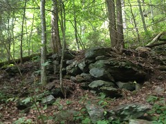
Old Rail Fortification

Pretty good evidence there.

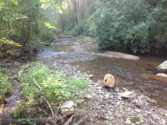
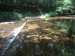
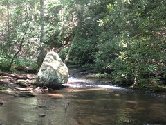
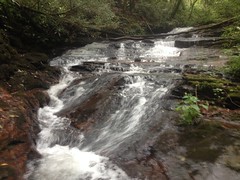
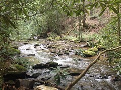
There were several small falls on the creek too, but none of them were particularly easy to see or get good photos of.

This was the best I could do at the first one.
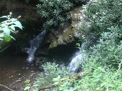
Bear Den Creek Falls

None of them had much in the way of pools either. It was clear why Raven Cliffs got to be the more popular trail.

I kept pushing north, and as generally seems to happen these days, I eventually got into rhododendron hell.

It was a good one too. The vegetation choked the creek and extended as far as I could see up both hillsides. There was just no way out of it except straight ahead, or straight back the other way.

I actually thought hard about whether to turn back, but eventually decided to keep going because the trail was a good ways up off of the creek, and despite being densely overgrown, was relatively easy to follow.

That too changed after a while though. I reached a bit of a flats and struggled to discern the trail from natural features. It seemed like they'd actually built up the railbed about a foot off of the surrounding ground. I'd never seen that before though. Way more often it's sunk down into it. I wasn't sure, gave up, and marked the trail as "indistinct" in my GPS.

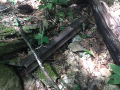
Right then though, literally that second, directly in my line of sight as I moved my GPS out of it, lay this spike:
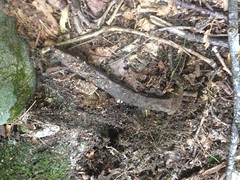
Spike

Given the sheer number of miles of old rail that I've explored, I've found surprisingly few artifacts. I always feel lucky when I do, but what are the odds I'd look directly at one at the exact moment that I questioned whether I was even in a suitable location to find it?

What are the odds?!

Rhododendron hell eventually gave way to rhododendron heck and I made much better progress until I hit the definitive end of the line.

If the old rail kept going, it did so via switchbacks that weren't cut into the ground.

The creek there was pretty crazy too, it kind-of looked like a box. Solid rock on all three sides for a few hundred feet or so.

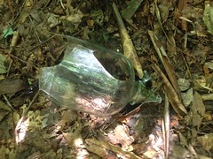
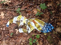
And there was a balloon, of course.
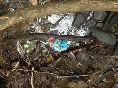
Mylar Balloon

Goes without saying.

I found what looked like an old skid a bit uphill from there, but it didn't appear to join the rail directly. It was a little confusing, actually. I'm still not sure what to make of it.

When the creek became a trickle, I gave up following it and just headed west until I hit the highway.
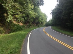
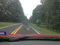
Hogpen Gap Road

Directly across from where I hit it, there was a muffler in a tree.
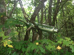
Muffler in a Tree

It glinted a bit, and caught my eye.

Wonder what the story is there.

There were several turn-outs along the road, and I checked out a few of them. In one, a tree was eating its Wilderness sign.
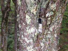
Tree Eating the Wilderness Sign

Another, I recognized. It had a big shade tree in the middle and Jonhhy, Norma and I'd stopped there for a half hour or so during our TNGA ride, way back.

Oh, glorious tree!
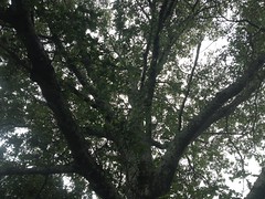
Shade Tree

I was hungry, so I stopped and had a little picnic under the same tree. Lots of memories there. Lots and lots.

When I got back to Bear Den Creek, I headed back up to the meadow and looked hard for Little Low Gap Creek and the trail that was alleged to exist in its vicinity.

I found the creek, and the old road/rail that led up along it, and the modern trail that parallels that. But there wasn't much back there. The old road/rail was overgrown. There were a few old-looking campsites too but the trail petered out just past the last one.

One interesting thing though... Somebody had hauled their entire patio set back there at some point.
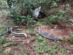
Patio Set

Nature seems to have had its way with it in the intervening years, but it must have been a pretty good site while it lasted.

That was about it. The light was fading and I'd had enough fun for one day.

On the way out, I passed back by the camp sites at the beginning of the Raven Cliffs Trail again. Some guy and some woman were having a great time joking and carrying on, but they were just getting way, way too carried away. She was screaming. I mean, literally screaming, as loud as she could, over and over, and getting hoarse from it. I could still hear her at the parking lot, which is like 100 yards away, with forest in between and rushing water to my left. The guy was super loud too, but his voice didn't carry that far. They were really just having fun, but if I'd been a police officer patrolling the lot, and I heard that, I'd have been really suspicious that they weren't. And, of course, that doesn't even take into consideration how annoying it must have been to the other campers. Fortunately there weren't too many of them, but still...

People are crazy. They do crazy things.
Sunday, August 23, 2015

Alpharetta Greenway

After riding with Sophie yesterday, I felt decent enough last night to attempt something a little more challenging today. My plan was to sleep in until 10 or 11, then head up to the mountains, take it easy, but get in some good climbing miles.

That was the plan.

But, this morning I woke to loud and prolonged thunder that reverberated like an explosion on the ground. It sounded so close that I even looked outside to see what was going on. Rain. That's what was going on. The radar looked terrible too. The mountains were under attack and looked like they'd continue to be for quite some time. I felt bad for the TNGA riders, but just the same, I wished I was one of them.

Instead, Iz and I took a ride on the Alpharetta Greenway. Close enough, right?

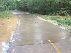
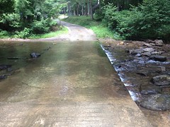
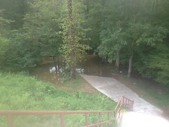
Well, it was an Adventure. Just past Mansell the trail was flooded, knee deep. We ended up taking the road over to Kimball Bridge and getting back on, but north of that it was flooded again.

Flooded Greenway

And again.

Less Flooded Greenway

Though less so than at Mansell.

Iz rode through that second one too fast, got her feet wet, got grossed out, you know, because water is gross, and decided to turn back.

On the way back, we'd hoped to find an easier way around the deluge at Mansell, so we stuck to the trail, rather than taking the road. Unfortunately the only options were through private property, and I'm not real big on trespassing.

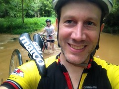
Fortunately, we rode through a dozen or more little flooded sections, Iz kept getting splashed, gave up on staying dry, and didn't mind crossing the flood when we got to it.

Me and Iz Crossing the Flood

Getting wet is funny. It sucks horribly when you're trying to stay dry, but once you accept being wet, it's amazing how not-a-big-deal it is compared to how big of a deal it was before accepting it. Of course, that assumes you're wearing the right clothes. Anything tight is good... Bathing suits, bike clothes, running tights, barefoot shoes, cycling shoes... All good. Anything loose is horrible... Boxers, tee shirts, tube socks, tennis shoes, pants of any kind...

I suggested we take our shoes and socks off, walk through the water, then put them back on, like we do in the woods. She didn't care about getting wet at that point but she insisted that I get my shoes wet too, which I guess was her idea of fair.

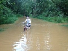
Did I mention that it was fairly deep? It was fairly deep.

Deepest Spot

So, it was a bit more of an Adventure than I expected to have in the middle of the city. Aside from being traumatized momentarily, Iz seemed to have an OK time. She definitely liked how fast we could go. We usually ride with Sophie, and though Sophie isn't terribly slow, Iz is way faster.

They're roughly equally fast and skilled hiking, but I might have to try to ride with them individually more often. For now at least, they do seem to get more out of it when it's just the two of us, than all three.

Blankets Creek

Yeah! I've worked my way all the way through the Adventure backlog. This one happened earlier today.

I've been sick for the past two weeks, but this morning I felt about 60% better. As the day wore on, I felt even better than that, and even good enough to expose myself to the outdoors.

It seemed fitting to ride bikes, as today was the start of the TNGA.

As much as I'd like to have been among them, I had a much easier day, and that was probably good.

Isabel was at her boyfriend's all day, so Sophie and I hit up Blanket's Creek by ourselves.

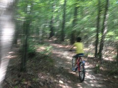
She's getting pretty fast these days. Fast enough to really be fun to ride with.

Sophie

Most of the time, at least. She does avoid using her gears, but on the Mosquito Flats, she doesn't really need them all that much.

We often see deer out there, but today they were everywhere. There were three bedded down in some fallen timber near the east entrance/exit of Van Michael's.

Deer

There was a buck poking around not too far past those, too. On the other side, there was another buck walking around, and then back near Van Michaels again later, we saw two more, one of which seemed to be in the midst of a sneezing fit.

I think we rode 5 laps, plus an out and back on Hamilton's, which Sophie described as "just back and forth on flat gravel, how much more boring could it be?" She's definitely getting to be a teenager. I had a great time though, and she seemed to as well, despite being bored to death at the end there.

She and her sister and I've been to Blankets and Allatoona both, a few times now. This was the first time where Sophie seemed confident enough that she just had a good time, though. She didn't seem to worry about whether she was able to ride the trail, she just rode it. I actually remember that happening to myself.

Hopefully there's more of that ahead.

AT Near Hogpen

The day after that Bull Mountain ride, I felt like I'd gotten run over by something. And, for the past two weeks, I haven't felt much better. I even started worrying that I'd managed to contract Lyme Disease, it was that bad. Fortunately, Kathryn seems to have caught whatever I've been fighting, so it's probably not Lyme Disease. Unfortunately, Kathryn seems to have caught whatever I've been fighting, so now she has to deal with it too.

Last weekend I told myself that if I took an easy hike, it'd be good for me. My spirits, at least.

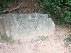
So, to that end, I got on the AT at Hogpen Gap.

Hogpen AT Marker

There were two motivations for that. The first: I'd never hiked that section. The second: I knew the old Byrd-Matthews rail ran north from Low Gap, but I wondered if it ran south as well, and if so, if the AT followed any section of it.

The trail there looks like it was purpose-built. No old roadbed, no old rail.

AT Near Hogpen

But the trail was beautiful, and not very technical, and I had a wonderful time, until I hit one of the long descents, and both my thighs started cramping. It would seem that I had not yet kicked whatever was ailing me. I tried pushing through it though, and when it flattened out again, I started feeling better. I didn't have any trouble climbing either, just descending.

I ran into a few people. One was Southbound: "Almost done, 46 miles to go!" "Woohoo!" The other was also Southbound, but had done it in sections. He'd gotten Lyme Disease in Vermont and had to take a year off, but he hoped to be done with Georgia before the end of this year.

At the time, Kathryn had not gotten sick yet, and his comments just made wonder even harder if that's what I had.

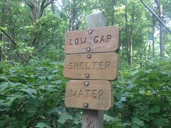
Low Gap was only like 4.4 miles from Hogpen, but I felt like I'd been walking for days. Every muscle hurt. Every joint.

Low Gap

I did notice something though. Actually, I'd noticed it the last time I was up there, but thought that I might have imagined it.

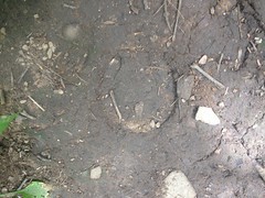
Hoofprints.

Hoofprints on the AT

They led in both directions near Low Gap.

I'd wondered the week before, assuming I hadn't imagined them, if they'd used mules to bring in supplies to work on the trail or work on the shelter. But, the tracks only went back and forth near the gap. FS880 lies to the north, and there appears to be a trail leading down to it. Maybe someone just climbed up to the gap from below and wandered about before realizing where they were and heading back down.

Odd.

I pushed north to Poplar Stump Gap. Indeed, the AT followed the old rail bed from Low Gap to Poplar Stump. Also, I found where it heads south from Low Gap. It bends around the west side of whatever that knob is there. I looked at some lidar data later too. I think it dives down off of the ridge to the north from there, more-or-less following FS880. While interesting, that's just not where expected it to go, and now it's just all that much more confusing.

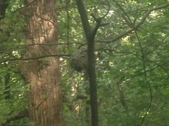
I'd seen all the yellow jackets a few weeks ago. This time it was hornets.

Hornet Nest

Oh yeah. That photo is good and blurry because I was a long way away and had to zoom in to get it. Not getting any closer.

I ate lunch somewhere between Poplar Stomp and Low Gap, but I hardly felt refueled. The push back was terrible. Indescribable. My feet felt broken. My calves hurt until the next Wednesday. I hadn't enjoy it in the least.

I did learn some things though, so it wasn't a total waste.

I also headed north down the back side of Hogpen...

Facing North on the Richard B Russel

...and drove all around the Craig Gap area at the bottom. I tried driving up FS880, but there was a bit of mud that I wasn't confident my little Saturn Vue could negotiate. Funny though, I wouldn't have thought twice in the Subaru or the Durango, and looking at it, it didn't immediately occur to me that I wasn't driving a 4-wheel drive vehicle with good clearance. I was just like "I need to keep two wheels over to the right... Oh, wait, little red flag going up..." I guess it's fortunate that the little flag went up when it did or I might still be stuck.

There's a bit to be explored back in there. It might be even be fun on the bike.

Later though, I need to kick this cold first.

Bull Mountain

This also happened long enough ago to be a little fuzzy in my mind. What was it, a week ago, two? The 9th. That's two.

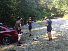
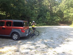
Ok, two weeks ago the frere and I felt like getting some good miles in at Bull Mountain. Mark, Marc and Eddie did too, so they met us there at about 9AM on Sunday morning.

Mark, Marc, and John Eddie

A crew of like 6 other guys also showed up. I didn't know any of them, but apparently Mark and Marc did and we all ended up riding out together.

On a side note, there were also some guys up there from Florida too, and I talked to them for a while about riding in Florida. Surprisingly, one of the guys had never ridden at Santos, despite having living there since before it was built. One of them also had a Litespeed Cohutta, which was cool because I'd been wanting to take a look at since it first came out.

But, that's a side note.

The main note...

Me and John and Mark and Marc and Eddie and the 6 other guys all rolled over to Bull Mountain together. We'd planned on getting in some long miles, so John and I both brought camelbacks with 100oz bladders. I don't know about his, but mine felt intolerably heavy. I mean, just intolerably. As I rode, I questioned the logic too. I rode the TNGA with two 24oz bottles and iodine tablets with no trouble finding water, and I knew every stream in the area. The water felt heavier than my bikepacking gear. Could it actually be? Either way though, I ought to be able to carry a load like that, and I eventually just gave up thinking about it, except when it would get sideways on me, and then I'd be like "Dangit Dave, how'd you get to be so soft?!"

At the foot of Bull, we all decided to "climb Bear Hare" which to me, Mark, Marc and Eddie meant circle around the back through Booger Holler, but I guess to the other guys it meant, climb Bull, descend the Whoops and then circle around the back, and they just quietly split off.

It was odd, but hey, we figured we'd meet them again eventually. Eventually, we did, but we did so descending Bull Mountain, which meant that they would be climbing Bull and descending Bare Hare. In retrospect, I'm not sure what they intended to do, but it's hard to have a bad ride out there, so I'm sure it worked out.

The new Booger Holler trail was as great as I'd remembered it from the last time, and this time I got to ride it the other direction, and get GPS data for it.

But, the climb up Bear Hare was difficult and I felt pretty bad doing it. I've said it before, and I'm sure I'll say it again. No amount of not climbing in the mountains can prepare you for climbing in the mountains. I definitely need to do more climbing, in the mountains.

It seems like I had some minor mechanical near the top, but I can't remember what it was.

I had a much more significant mechanical on the way down though.

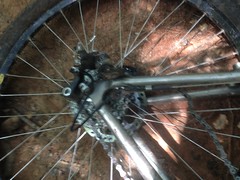
Wrapped Up

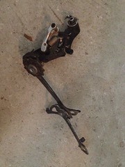
I'd apparently cracked the parallelogram on that ride with Billy a few weeks back. It fatigued and failed, spontaneously, went flying into my spokes, and blew itself to pieces against the chain stay. I haven't seen a more spectacular derailleur failure, except possibly when Tim's took out almost all of his spokes.

Terrible.

Derailleur Carnage

I was still about 5 miles from the car, but it was fortunately almost all downhill. John volunteered to pick me up, but I managed to get all the way to the last little climb up to Nimblewill Church Road before I ran into him.

I'm not sure how the rest of the guys fared. Hopefully their rides turned out better than mine.

John had a spare 9-speed XTR derailleur at his place, for some reason, and I put it on my bike today. Hopefully I can keep from destroying it anytime soon.

Low Gap Creek (again)

Goodness, this happened so long ago that I don't have a clear memory of it now. Busy, busy, busy...

Lets see if looking at the photos jogs my memory...

Ah yes, it would seem that I'd hacked my way up Low Gap Creek, only to run completely out of time, and return the next weekend to try to get the job done for real.

It would seem that I started south of the campground again, and took a photo of the first ford, rather than the second.

Ford on Low Gap Creek

And, it's starting to really come back now...

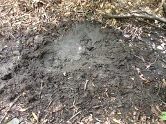
Not too far off the beaten path I started seeing more pig sign. Not so much rooting this time, but lots of wallowing.

Hog Wallow

Not a big fan of gigantic feral pigs. So far they've left me alone though, and I've certainly made good use of their trails, but still, not a fan.
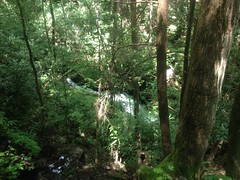
Kind-of knowing where I was going, I made really good progress compared to the week before. I pushed past my previous mark with no danger of running out of time. Sadly, the trail became quite difficult to follow not even a quarter mile upstream from there and I found myself moving much more slowly from then on.

If you're ever looking at a map, and there's a spot that looks nice and flat and inviting, where a couple of creeks come together, at the base of the surrounding hills, you may imagine a serene little valley, but odds are it's rhododenron hell down in there. I've seen places where it's not, but I've seen way more where it is. I hit rhododendron hell almost immediately. The old railbed was exceedingly difficult to follow. It was like videos I've watched of people working their way through mangroves, just without the water and crocodiles.
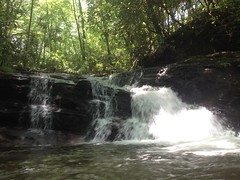
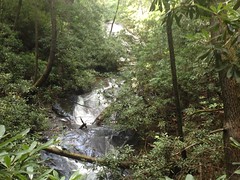
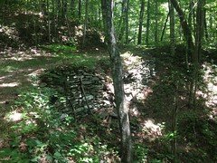
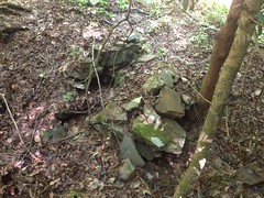
Several times I was sure that I'd lost the trail, but then I'd find some old fortification...

Fortification

...or remnant of an old bridge...

Bridge Remant

... or a bench cut, and I'd see that no, I was still on track.

There are two rhododendron hells between the Beech Meadow and the head of Low Gap Creek, and the trail between them isn't much less overgrown, just a little easier to follow.

You know what else there is up there? Yellow Jackets.

Yellow Jacket Nest

Lots and lots of Yellow Jackets. I saw at least 6 nests.

Go Tech.

Since the AT along the ridge follows an old rail north from at least Poplar Stomp Gap, and Low Gap is just a mile or so south of Poplar Stomp, I'd assumed that the rail led up the creek, all the way to Low Gap, and then proceeded north along the ridge.

But...

Not a quarter mile from the gap, it just gets way too steep. The rail couldn't possibly have continued without an extensive network of switchbacks. No such thing appeared to exist, and I looked hard. The hillside looked like it could have accommodated them, if anyone had wanted to build them, but there was no trace. If such a thing existed, then it was entirely elevated and now, entirely gone.

I whacked uphill along the creek until I found what I thought was another pig trail. It got wider and wider though, and eventually led to the Low Gap Shelter.

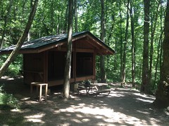
Low Gap Shelter

There were 4 guys there (not pictured), hanging out, taking a breather, and we had the standard "where you coming from" kind of discussion. They were hiking the Georgia section, had been on the trail since Amicalola, and were heading to Poplar Stomp to make camp. I didn't want to be too much of a nuisance, and I had questions to answer, so I didn't stay long.

At Low Gap proper...

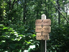
Low Gap

I hung a right and explored a bit of the AT. It appeared to be an old rail bed to the north.

Fortified Stream Crossing on the AT

But there wasn't any evidence of switchbacks or any side track in that direction.

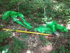
The only interesting thing that I found up there was a stash of tools.

Tool Stash

They weren't very inconspicuously stashed though. The bright green tarp and bright yellow handles made them easy to spot. They were a ways up the trail from the gap. It seemed odd that they weren't stashed closer to the shelter. I'm sure there's a reason though.

I didn't push too far north before turning back. I'd made good time, but I was a long way from the car, didn't see a good alternative route back to it, and still had two rhododendron hells ahead of me.

On the way back I passed the quartet that I'd seen at the shelter earlier and wished them luck.

The AT south of Low Gap appeared to be purpose built singletrack. If the rail continued south, the AT didn't follow it. I explored most of the campground there, looking for switchbacks, or curves, or any indication that the rail dove down off the ridge toward the creek, but I couldn't find a thing.

It was quite a puzzle. There were clearly railbeds on the ridge, and up the creek, to within a quarter mile or less of the ridge. It seemed like that the two ought to be connected, but maybe they weren't.

Weird.

I pondered my options again, and decided, yes, the best route back would be a direct abort, right back downhill. But, first things first. My feet needed a little rest.

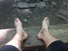
Dirty Feet

And my body needed a little fuel.

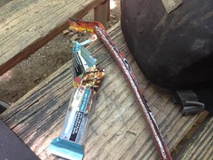
Lunch

I might have enjoyed the rest a little too much. When I got going again, the trail seemed a bit rough.

I managed to follow the "pig trail" a little more carefully downhill and stay on it all the way to the creek, where it joined the old rail. It got wider and deeper and looked like it may have been a skid at some point. I guess the rail led as far upstream as possible and timber was just skidded down to it from either side. It seems unlikely that it connected with the rail along the ridge at Low Gap. The rail along the ridge must have been built later, possibly after winning the court battle with Vandiver in 1916 and gaining access to the ridge from Poplar Stomp Gap.

Or, maybe there's some other explanation. Who knows. Maybe the guy that wrote this book, which I plan on getting at my earliest opportunity.

Anyway, musings aside, I'd committed to a direct abort, and I made my way as quickly as possible back downstream. I bypassed much of the rhodoendron hell by sticking to the neighboring hillside, but I did get forced down into it a few times.

I also explored some of the side trails leading to and from the Beech Meadow.

(The Beech Meadow)

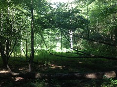
Beech Meadow

They also looked like skids, or at least didn't look like rails.

The previous week, and on the way up, I'd seen what looked like the footing of an old trestle in the middle of a feeder creek.

Old Trestle Footing

Got a photo of it this time.

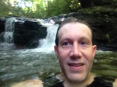
I went for another quick swim in the pool at the top of the second falls too.

Swim

And this time I remembered to take a selfie.

Since the previous week, a new tree had managed to lodge itself in the pool though, entirely obscured underwater, with branches sticking up. As such, jumping off the falls would have been ill advised.

On the way up, I'd actually heard other people, down on the creek, and seen their footprints on the trail. I couldn't see them, but I assumed they were fishermen, just using the trail to access the creek. I didn't see them on the way back, but I saw their southbound footprints. I kind-of hoped I didn't catch them though. I've run into people before when they expected to be inaccessibly far back in the woods. No way to tell how people will react when they don't expect to run into anyone.

I can't remember if it was that weekend or the weekend before, but two guys (and their old ladies) had ridden Harleys all the way to the back of the campground and really struggled to turn them around. I was walking down the road from the north, right as they were trying. The bikes were super loud and dozens of campers were all standing there, staring at them, like a mob. I kind of felt bad for them, actually, though I did wonder why it seemed like a good idea to ride a street bike that far down a gravel road.

Other than all that, there's not much else to write about. I walked out, got in the truck, and headed home.

Goodbye Low Gap Creek.

Low Gap Creek

Thanks for the good times. It may be a while before we meet again.

Friday, August 7, 2015

Low Gap Creek

The backlog is shrinking. Only 2-deep now. Lets see if I can knock out another one...

Not last Saturday, but the Saturday before, I made my way back up to the Upper Chattahoochee to put my follow-that-old-rail-bed skills to the test, once again. Feeling reasonably tired of the Chattahoochee itself though, I turned my attention to Low Gap Creek. The Low Gap Creek Campground was allegedly a logging camp at one point. There's a definitive old railbed heading south from it that tees into the old Chattahoochee rail, and the lidar data clearly shows more to the north, including several of what appear to be switchbacks.

The Upper Chattahoochee is north of Helen, and the town of Helen is such a popular destination this time of year that it can take 45 minutes or more just to get through it. I usually circumvent the madness on Asbestos Road. I'm not alone in this, and on a good weekend, I'm joined by all sorts of colorful characters. This time I got behind some guy rollin' coal.

Rollin Coal

Man, the photo just doesn't do it justice. The thick, black smokescreen looked like something out of James Bond. Every single hill.

He took a left though and I took a right, so I only got to "enjoy" it for a mile or so.

I parked south of the campground in one of the two spots reserved for day use. There are only two spots. Offhand that would seem to under-serve the area, but in the last 15 years, I've never seen either of them occupied, except by myself. And the other spot has never been occupied upon my return.

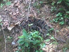
North of the campground a guy was poking a stick at a timber rattler.

Timber Rattler

Not sure I'd be poking a stick at it, but it didn't seem too upset about it. No rattle. A far cry from that one I ran into on Tibbs a few weeks back.

I approached the ford in the creek...

Low Gap Creek Ford

Took in the natural beauty for a minute...

Boulder on Low Gap Creek

And got down to it.

Years ago I'd been up that way, looking for Low Branch Falls. I'd found a waterfall, but it didn't look much like other photos alleged to be of the same waterfall.

This time I wasn't looking for waterfalls, but from that excursion, I was fairly familiar with the trails in the immediate area. This helped, and I was able to locate the old railbed right away. A little exploration revealed that part of it had at one point been converted to a road and rerouted. There's even a "closed to vehicles" sign back there, but it looks like it's been a very long time since you could have driven up to the sign.

The rail though... It crisscrosses Low Gap Creek twice before ascending up an old overgrown bench cut along England Camp Branch which ends abruptly. There must have been a bridge there at one point because it picks up on the other side, leads directly to this waterfall (which is not on Low Gap Creek, but is the one I think people end up finding and taking photos of)...

England Camp Branch Falls

And switches back right there.

Past the switchback, the trail appears to get a lot more traffic, though "a lot" is definitely relative. It looked like maybe people boulder hop along the creek and scramble up the falls, rather than following the old rail directly.

The trail was remarkably easy to follow from there on. It looked a lot like the old rail along the Chattahoochee, just a bit more overgrown. There were a few spots with truly difficult deadfall, but it was mostly not-too-bad.

There were two spots where small feeder creeks came in from the left, and there must have been trestles there at some point because the main trail disappears, a small worn-in trail continues, and then the main trail picks back up on the other side.

There was another waterfall along Low Gap Creek itself, above the one I'd originally found way back.

It seemed to be really tall and composed of multiple cascades. Unfortunately I couldn't get too good of a look at the whole thing, just bits and pieces of it.

Low Gap Creek Falls 2

The trail led directly to the top of it though, and there was a decent pool at the upper cascade.

Low Gap Creek Falls 2 Upper Cascade

It was in the high 90's at the time, so I took a short swim, and man, was it refreshing. The cascade was only 4 or 5 feet tall too, so I even climbed up on it and jumped off a few times. Ha! Picture that. All by myself, just for fun, nobody to watch me, jumping into the water like a kid. Kathryn was like "Why didn't you take a selfie in front of the falls?" "Because I'm not our 15 year old daughter?" It doesn't occur to me to take photos of myself except when there are cyclists behind me. Maybe I should take a few more though.

At any rate, after playing around a bit, I made my way upstream.

There was another falls further up too.

Low Gap Creek Falls 3

Also quite tall. Didn't look like it had much of a pool at the bottom.

The old rail switched back twice there, presumably to get up over the falls.

The switchbacks were fortified with stacked stone in the same way I'd seen creek crossing fortified before.

Fortified Switchback

Out at the end of one of the switchbacks there was an old fire ring, and some piece of metal, presumably somehow related to the rail. Maybe some part of the switching mechanism itself.

Something or Other from the old Rail

Not far after that, I found a dead mouse on the side of the trail, being eaten by yellow jackets.

Mouse and Yellow Jackets

Poor little guy.

North of that, the trail was quite a bit more wide open than it had been earlier. There were long stretches without deadfall, and very little overgrowth to speak of. It didn't look like the trail got much more traffic there though. Just some quirk of nature kept it clear, I guess.

Upper Low Gap Creek Trail

There was an old spike sticking out of the ground near a creek crossing.

Spike

No doubt that once helped hold a trestle together.

And then I found this old moonshine jug.

Moonshine Jug

Hey! I'd been there before!

Way back on that first excursion up that way, I'd followed another trail that crossed right there.

At the time, I'd marked on my map that there was a spur leading north. I hadn't seen the one leading south.

The rail crossed the creek and bent north. There were ribbons leading west, but that was definitely not the right way to go.

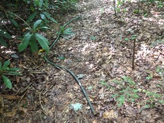
Half of an old garden hose lay there in the middle of the trail.

Garden Hose

Weird. Was it somehow related to moonshining? If it was, it was from a very long time ago.

Past the garden hose there was a small meadow. It was starting to get taken over by beech trees, but they hadn't filled it in yet.

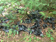
There was a huge amount of deteriorating black plastic up there though.

All the Plastic in the World

It was riddled with aluminum cans and other garbage, but the plastic didn't look like garbage bags. It was thick. It wasn't that erosion barrier material though. I was honestly stumped. I kept finding it to the north too, like it had originated upstream, and the whole clump had somehow ended up there. Upstream was Wilderness though. There were even signs to that effect posted on trees along the northern edge of the meadow. That just added to the mystery.

Several beech trees had fallen over into the meadow, recovered, and kept on growing.

A piece of plywood had been nailed to a pair of them, making a neat little table.

Old Fish Cleaning Table

For cleaning fish? I've found several makeshift fish cleaning tables over the years. Who knows though, it could be for anything. Whatever it was for, it hasn't been used in a while.

I pushed on upstream. The rail crossed the creek and resumed on the west side. It kept going and going.

I kept an eye on the time. I had to pick my mom up from my brother's house that evening around 10. It takes an hour to get from my place to my brother's, and it takes two hours to eat and get back to my place from Helen. So, I needed to be out of the woods by 7. It was about 4. I'd gotten started around noon. I had about three hours to get back. On the way up, I'd spent a lot of time poking around and double-checking that I was going the right way. The trip back down really shouldn't take three hours... I gave myself another fifteen minutes.

I'd kind of hoped to either run out of trail or something, but no, it just kept on going, clear as a bell.

There was what appeared to be a switchback on the other side though, so when I did finally turn back, I took that rather than making a direct abort.

Turned out it wasn't a switchback, but just an old road that also led to that beech meadow.

Mylar Balloon

Of course, there was a mylar balloon lying there on that road, as I imagine there is in every square mile of the woods.

I made great time on the way back. The trail seemed more overgrown on the way back than it had on the way out though. I guess it was just because I was moving faster. Funny though, I really noticed it, and I don't usually.

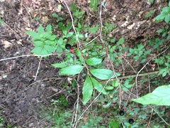
Berries of some kind were growing all over too. I hadn't noticed them on the way up either. I've also seen them in and amongst blueberries on Trail Ridge. I don't know what they are though, so I took a photo so I could do a little research.

What Are These

Still haven't done that though. It's been a busy couple of weeks.

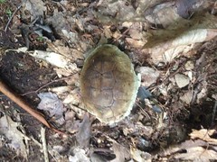
I took a slightly different route out and found this old sunbleached turtle shell on the side of the trail.

Turtle Shell

And that was about it.

Goodbye Low Gap Creek.

Low Gap Creek

Your mysteries are not yet entirely revealed, but perhaps they will be soon.

I did make it out in time, did make it home in time, and did pick up my mom in time. I then stayed up all night, took her to the airport at 4AM. Talk about a full day. A long, long, full day.

I slept in on Sunday.