Goodness, this happened so long ago that I don't have a clear memory of it now. Busy, busy, busy...
Lets see if looking at the photos jogs my memory...
Ah yes, it would seem that I'd hacked my way up Low Gap Creek, only to run completely out of time, and return the next weekend to try to get the job done for real.
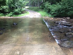
It would seem that I started south of the campground again, and took a photo of the first ford, rather than the second.
And, it's starting to really come back now...
Not too far off the beaten path I started seeing more pig sign. Not so much rooting this time, but lots of wallowing.
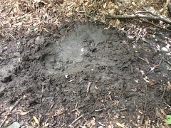
Not a big fan of gigantic feral pigs. So far they've left me alone though, and I've certainly made good use of their trails, but still, not a fan.
Kind-of knowing where I was going, I made really good progress compared to the week before. I pushed past my previous mark with no danger of running out of time. Sadly, the trail became quite difficult to follow not even a quarter mile upstream from there and I found myself moving much more slowly from then on.
If you're ever looking at a map, and there's a spot that looks nice and flat and inviting, where a couple of creeks come together, at the base of the surrounding hills, you may imagine a serene little valley, but odds are it's rhododenron hell down in there. I've seen places where it's not, but I've seen way more where it is. I hit rhododendron hell almost immediately. The old railbed was exceedingly difficult to follow. It was like videos I've watched of people working their way through mangroves, just without the water and crocodiles.
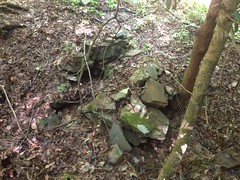
Several times I was sure that I'd lost the trail, but then I'd find some old fortification...
...or remnant of an old bridge...
... or a bench cut, and I'd see that no, I was still on track.
There are two rhododendron hells between the Beech Meadow and the head of Low Gap Creek, and the trail between them isn't much less overgrown, just a little easier to follow.
You know what else there is up there? Yellow Jackets.
Lots and lots of Yellow Jackets. I saw at least 6 nests.
Go Tech.
Since the AT along the ridge follows an old rail north from at least Poplar Stomp Gap, and Low Gap is just a mile or so south of Poplar Stomp, I'd assumed that the rail led up the creek, all the way to Low Gap, and then proceeded north along the ridge.
But...
Not a quarter mile from the gap, it just gets way too steep. The rail couldn't possibly have continued without an extensive network of switchbacks. No such thing appeared to exist, and I looked hard. The hillside looked like it could have accommodated them, if anyone had wanted to build them, but there was no trace. If such a thing existed, then it was entirely elevated and now, entirely gone.
I whacked uphill along the creek until I found what I thought was another pig trail. It got wider and wider though, and eventually led to the Low Gap Shelter.
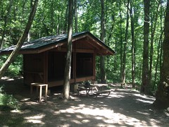
There were 4 guys there (not pictured), hanging out, taking a breather, and we had the standard "where you coming from" kind of discussion. They were hiking the Georgia section, had been on the trail since Amicalola, and were heading to Poplar Stomp to make camp. I didn't want to be too much of a nuisance, and I had questions to answer, so I didn't stay long.
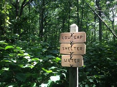
At Low Gap proper...
I hung a right and explored a bit of the AT. It appeared to be an old rail bed to the north.
But there wasn't any evidence of switchbacks or any side track in that direction.
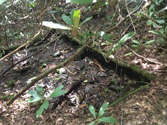
The only interesting thing that I found up there was a stash of tools.
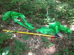
They weren't very inconspicuously stashed though. The bright green tarp and bright yellow handles made them easy to spot. They were a ways up the trail from the gap. It seemed odd that they weren't stashed closer to the shelter. I'm sure there's a reason though.
I didn't push too far north before turning back. I'd made good time, but I was a long way from the car, didn't see a good alternative route back to it, and still had two rhododendron hells ahead of me.
On the way back I passed the quartet that I'd seen at the shelter earlier and wished them luck.
The AT south of Low Gap appeared to be purpose built singletrack. If the rail continued south, the AT didn't follow it. I explored most of the campground there, looking for switchbacks, or curves, or any indication that the rail dove down off the ridge toward the creek, but I couldn't find a thing.
It was quite a puzzle. There were clearly railbeds on the ridge, and up the creek, to within a quarter mile or less of the ridge. It seemed like that the two ought to be connected, but maybe they weren't.
Weird.
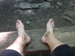
I pondered my options again, and decided, yes, the best route back would be a direct abort, right back downhill. But, first things first. My feet needed a little rest.
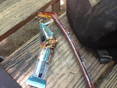
And my body needed a little fuel.
I might have enjoyed the rest a little too much. When I got going again, the trail seemed a bit rough.
I managed to follow the "pig trail" a little more carefully downhill and stay on it all the way to the creek, where it joined the old rail. It got wider and deeper and looked like it may have been a skid at some point. I guess the rail led as far upstream as possible and timber was just skidded down to it from either side. It seems unlikely that it connected with the rail along the ridge at Low Gap. The rail along the ridge must have been built later, possibly after winning the court battle with Vandiver in 1916 and gaining access to the ridge from Poplar Stomp Gap.
Or, maybe there's some other explanation. Who knows. Maybe the guy that wrote this book, which I plan on getting at my earliest opportunity.
Anyway, musings aside, I'd committed to a direct abort, and I made my way as quickly as possible back downstream. I bypassed much of the rhodoendron hell by sticking to the neighboring hillside, but I did get forced down into it a few times.
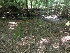
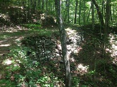
I also explored some of the side trails leading to and from the Beech Meadow.
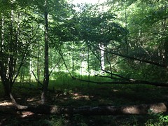
(The Beech Meadow)
They also looked like skids, or at least didn't look like rails.
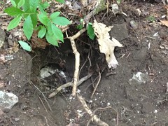
The previous week, and on the way up, I'd seen what looked like the footing of an old trestle in the middle of a feeder creek.
Got a photo of it this time.
I went for another quick swim in the pool at the top of the second falls too.
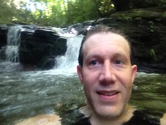
And this time I remembered to take a selfie.
Since the previous week, a new tree had managed to lodge itself in the pool though, entirely obscured underwater, with branches sticking up. As such, jumping off the falls would have been ill advised.
On the way up, I'd actually heard other people, down on the creek, and seen their footprints on the trail. I couldn't see them, but I assumed they were fishermen, just using the trail to access the creek. I didn't see them on the way back, but I saw their southbound footprints. I kind-of hoped I didn't catch them though. I've run into people before when they expected to be inaccessibly far back in the woods. No way to tell how people will react when they don't expect to run into anyone.
I can't remember if it was that weekend or the weekend before, but two guys (and their old ladies) had ridden Harleys all the way to the back of the campground and really struggled to turn them around. I was walking down the road from the north, right as they were trying. The bikes were super loud and dozens of campers were all standing there, staring at them, like a mob. I kind of felt bad for them, actually, though I did wonder why it seemed like a good idea to ride a street bike that far down a gravel road.
Other than all that, there's not much else to write about. I walked out, got in the truck, and headed home.
Goodbye Low Gap Creek.
Thanks for the good times. It may be a while before we meet again.


No comments:
Post a Comment