Oh man, I've got an Adventure backlog. It's like 3 Adventures deep, even. Too much work lately.
About two weeks ago I went back up to try to actually, correctly do what I'd failed at so spectacularly the week before - follow the Chattahoochee from the upper campground to the AT. Long story short, I was successful. Long story long, here's how...
I don't even remember what time I got up. I remember it was earlier than usual, but that's all I remember. I also remember that I was tired on the drive up, so maybe it was legitimately early, not just early for me.
Aside from being tired, the drive up was fairly standard and uneventful.
I drove up FS44, parked outside of the campground and trekked up the bits of the route I'd already covered. The one new thing that I noticed was that the trail on the west side of the river looked a lot like an old railbed too. The first time I was up there it seemed too steep. The second time I was up there I saw what appeared to be clear indications of a rail on the east side and imagined a crazy trestle climbing up over the falls. Since then I ran the numbers and the west side trail is well within range. So now I'm not sure what to make of it. Seems unlikely they'd have multiple rails and a switch right there. Who knows though, people build crazy things sometimes.
So, I proceeded uphill to the confluence that I'd gotten confused at last time. This time I searched much harder for the continuation of the old rail and I eventually found it. It seemed like I was more or less alone in that though. There were fewer signs of traffic from there on. Human traffic, at least. Plenty of pig traffic though. Plenty of that.
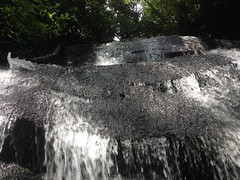
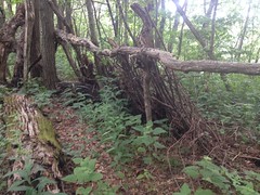
If a bit overgrown, the trail was easy to follow for a while, but then it seemed to end abruptly at a little feeder creek. I looked all around but I couldn't find anything resembling what I'd been following. I did find 2 bench cuts at 90 degree angles to the trail. One of them ended abruptly too though. It made no sense at the time, but looking at the GPS data on the map at home later, it became clear that I'd found a pair of switchbacks.
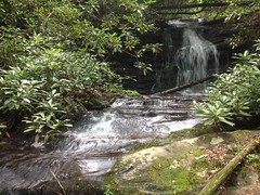
They'd apparently been built to get up over this massive falls.
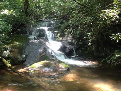
Dangit, I wish I had a buddy to stand down at the bottom for scale!
Dang it.
Since I didn't understand what the heck was going on, I bushwhacked for a while up above the falls before eventually stumbling onto the trail again at the foot of Coon Den Ridge.
There was another massive falls just up whatever creek tees in from the west there.
And there was a skid or something heading up along the creek. Someday I'll have to get back out there and see where it goes, but I had other objectives that day.
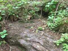
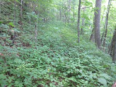
Down where the creeks came together it looked like people used to camp there quite a bit. It was wide and flat, and there were several old fire rings, now overgrown with moss.
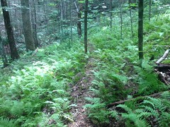
I followed the vague notion of a trail north. It was indistinct and braided, but whenever I'd think it had ended, I'd pick it up again. Humankind did not appear to have had much of a hand in the construction of that trail. Or, if they had originally, it had long been handed over to the pigs. There were signs of rooting on both sides, all the way up to the next confluence.
It's funny, if you look at it on a map, it seems likely that at the next confluence, the Chattahoochee proper continues due north to Red Clay Gap. But when you're there in real life, it's clear that the branch coming down from the northwest is the major contributor. Maps don't specifically say which branch is the river itself, but given that Chattahoochee Gap is uphill to the northwest, that seemed like the right way to go.
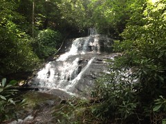
There was, at first, unfortunately, no indication of a trail, of any kind, man or pig. But it wasn't long before I picked up an increasingly distinct pig trail. It led up to yet another massive falls.
And yet again I wished I had another human there for scale.
As below, the trail was braided and indistinct, but when I'd lose it, I'd always pick it right back up again.
Presuming me unimpressed with obscure waterfalls, the woods began to court me with additional, increasingly interesting curiosities.
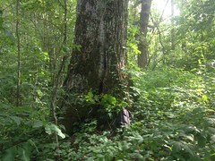
There were several large poplars.
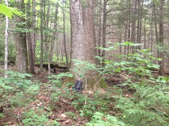
And a fairly large oak.
Not terribly unusual, granted... At least for that area.
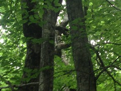
But then there was this owl.
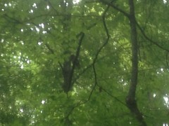
Which I got a garbage picture of, but it's there nonetheless.
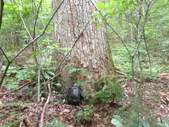
And there was a chisel.
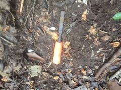
Lying there. Randomly.
And a tarp.
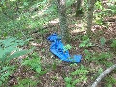
At first I thought it might be a shelter, but after looking at it a bit more, it didn't seem so. I wondered if maybe it had blown off of somebody's camp site on the AT and ended up there. There was another blue tarp about 100 yards uphill, half buried in leaves, but I failed to get a photo of it.
The last push up to the gap was a little difficult, but someone or something clearly went that way, somewhat regularly. I eventually emerged on a purpose-built trail, staring at what appeared to be the source of the Chattahoochee River.
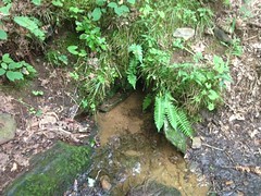
There's just a little hole in the ground there, and the river comes bubbling up out of it.
Turns out that might not be the actual source though. Just uphill there was a much larger spring.
At the time it was just damp and barely dripping, but I could imagine that after a good rain it runs out, flows downhill a bit, then into the ground, before emerging again at that hole I'd seen earlier.
Well, whichever is the source, I have now seen them both.
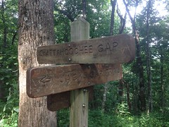
The little trail switched a few times and deposited me on the AT, at Chattahoochee Gap.
The Jacks Gap trail led off to the north, and there was a couple there who'd just hiked over from Brasstown and were about to head back. I talked to them for a bit. They were up from Florida, training for a rim-to-rim hike in the Grand Canyon later this year. They had to get moving though, so we didn't hang out for long.
I had a seat though, and had some lunch.
I don't remember now what time it was, but it was still relatively early. The hard part was behind me too. From there I'd planned on following the AT to Poplar Stomp Gap and then taking the old road back down to the car. It was all clean trail, old road, or gravel road.
Well... I say that...
If you look at the Lidar data for the area, there are what appear to be several bench cuts that diverge from and rejoin the AT. I was very interested in them. The last time I was up there, the AT appeared to be more old railbed, and I suspected that these bench cuts were too. One of them led directly to Chattahoochee Gap. To the south, I could see the AT heading west around the next knob, and the old railbed heading to the east.
I followed the old rail.
The first few hundred yards were clearly used as a campground. Past that it became somewhat overgrown. There was a clear trail through it, but the brush encroached annoyingly.
I found several fortified stream crossings though.
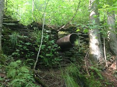
It was clearly an old railbed.
One very long section was 100% poison ivy.
100%, for a loooong time. I am fortunately not allergic, because there was literally no possibility of avoiding it without turning around or climbing up onto the ridge.
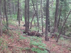
And then as if to reward my perseverance...
Two black bears appeared below me. One paused long enough for a photo.
Ok, a very blurry photo, but I swear that's a bear in the middle. That blackish spot.
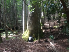
And there was another large oak in one of the gaps.
I could imagine it standing there in the gap a hundred years ago, with the entire mountainside logged out around it in every direction. It would have been visible from the camp, and it might have been a decent landmark, both for locating the gap from below, and for engineers running back and forth along the ridge.
There was a black rat snake up there too.
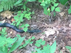
Big surprise there, eh?
Somebody had built a wind break behind their campsite in another gap.
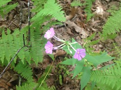
These purple flowers were everywhere.
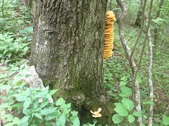
This tree had a lot going on... It was fairly large, to begin with. There were also two millipedes were either fighting or getting it on. And, when I stopped to look at them, I noticed all that yellow fungus growing all over it too.
So, yes, the bench cuts apparent on the lidar data do, in fact, appear to be old railbeds. There appears to be an old rail up there, leading at least from Poplar Stump Gap to Chattahoochee Gap. One day I'll have to hike it from Hogpen to Unicoi and see if I can figure out exactly how far it goes.
When I got back on the AT, it became familiar. I passed the spot that I'd bushwhacked up to the last time. Toward Poplar Stomp, there were a series of rhododendron tunnels.
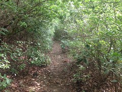
Rhodo tunnels always remind me of riding on Laurel Mountain in Pisgah. I think that's where I first saw one.
Ok, from THERE on, it was trail and road. No more bushwhacking. I started jogging and making much better time than I had been.
And then my phone rang. Ha! Cell phones in the Wilderness. Always seems strange to me that it's possible for a cell phone to ring up there. It was my mom. My brother Daniel was going to be in town, unexpectedly. If I could get back to Smyrna for 9PM, we could all eat dinner together. My rough mental math made it seem like if I kept moving, I could just about make it.
Sadly, or fortunately, depending on how you think about it, though I meant to be trucking it back home, I kept getting distracted by more weird and interesting stuff.
There were tons of big red mushrooms that looked like little gnome hats. Somebody had rigged up a rotisserie at one of the campsites.
There was another owl.
Down along Old Poplar Stomp Road, there was more too. A bear had very recently torn into one of the trees. Lower down the road, I found more stacked-stone fortifications. Just more evidence that the entire road was once a railbed. There was an old refrigerator tossed to the side too and an industrial lawn mower parked at the very bottom.
But! Wilder than any of that.
I heard all kinds of shuffling noises up ahead and downhill to the right. I knew what it must be, but I hardly believed it when I saw them.
Pigs. Feral pigs. Gigantic, enormous feral pigs. They were totally preoccupied and had no idea I was there. I kept taking better and better photos of them, and I even got some video.
They only saw me when I leapt down off of the little mound at the edge of the road, and they all took off downhill when they did. Good thing too, because I've seen that movie Snatch and I'm not a big fan of gigantic pigs.
After that, it was an uneventful push back to the car. I did manage to make it back to town in time to have dinner with my brother, and even though I was a bit dirty from the day's Adventure, and perhaps a little under-dressed, we ate outside and nobody seemed to care.
Yeah! Railbeds, waterfalls, owls, giant trees, posion ivy, bear and pigs! That's what it's about. That right there. Definitely one of the best days I've had, running around in the woods, to date.


No comments:
Post a Comment