The day after that Bull Mountain ride, I felt like I'd gotten run over by something. And, for the past two weeks, I haven't felt much better. I even started worrying that I'd managed to contract Lyme Disease, it was that bad. Fortunately, Kathryn seems to have caught whatever I've been fighting, so it's probably not Lyme Disease. Unfortunately, Kathryn seems to have caught whatever I've been fighting, so now she has to deal with it too.
Last weekend I told myself that if I took an easy hike, it'd be good for me. My spirits, at least.
So, to that end, I got on the AT at Hogpen Gap.
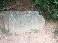
There were two motivations for that. The first: I'd never hiked that section. The second: I knew the old Byrd-Matthews rail ran north from Low Gap, but I wondered if it ran south as well, and if so, if the AT followed any section of it.
The trail there looks like it was purpose-built. No old roadbed, no old rail.

But the trail was beautiful, and not very technical, and I had a wonderful time, until I hit one of the long descents, and both my thighs started cramping. It would seem that I had not yet kicked whatever was ailing me. I tried pushing through it though, and when it flattened out again, I started feeling better. I didn't have any trouble climbing either, just descending.
I ran into a few people. One was Southbound: "Almost done, 46 miles to go!" "Woohoo!" The other was also Southbound, but had done it in sections. He'd gotten Lyme Disease in Vermont and had to take a year off, but he hoped to be done with Georgia before the end of this year.
At the time, Kathryn had not gotten sick yet, and his comments just made wonder even harder if that's what I had.
Low Gap was only like 4.4 miles from Hogpen, but I felt like I'd been walking for days. Every muscle hurt. Every joint.
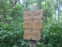
I did notice something though. Actually, I'd noticed it the last time I was up there, but thought that I might have imagined it.
Hoofprints.
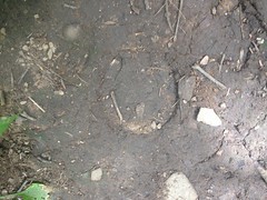
They led in both directions near Low Gap.
I'd wondered the week before, assuming I hadn't imagined them, if they'd used mules to bring in supplies to work on the trail or work on the shelter. But, the tracks only went back and forth near the gap. FS880 lies to the north, and there appears to be a trail leading down to it. Maybe someone just climbed up to the gap from below and wandered about before realizing where they were and heading back down.
Odd.
I pushed north to Poplar Stump Gap. Indeed, the AT followed the old rail bed from Low Gap to Poplar Stump. Also, I found where it heads south from Low Gap. It bends around the west side of whatever that knob is there. I looked at some lidar data later too. I think it dives down off of the ridge to the north from there, more-or-less following FS880. While interesting, that's just not where expected it to go, and now it's just all that much more confusing.
I'd seen all the yellow jackets a few weeks ago. This time it was hornets.
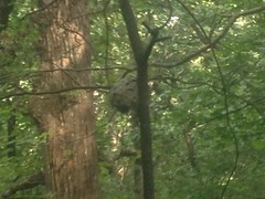
Oh yeah. That photo is good and blurry because I was a long way away and had to zoom in to get it. Not getting any closer.
I ate lunch somewhere between Poplar Stomp and Low Gap, but I hardly felt refueled. The push back was terrible. Indescribable. My feet felt broken. My calves hurt until the next Wednesday. I hadn't enjoy it in the least.
I did learn some things though, so it wasn't a total waste.
I also headed north down the back side of Hogpen...
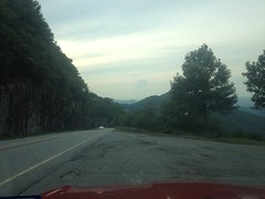
...and drove all around the Craig Gap area at the bottom. I tried driving up FS880, but there was a bit of mud that I wasn't confident my little Saturn Vue could negotiate. Funny though, I wouldn't have thought twice in the Subaru or the Durango, and looking at it, it didn't immediately occur to me that I wasn't driving a 4-wheel drive vehicle with good clearance. I was just like "I need to keep two wheels over to the right... Oh, wait, little red flag going up..." I guess it's fortunate that the little flag went up when it did or I might still be stuck.
There's a bit to be explored back in there. It might be even be fun on the bike.
Later though, I need to kick this cold first.


No comments:
Post a Comment