The backlog is shrinking. Only 2-deep now. Lets see if I can knock out another one...
Not last Saturday, but the Saturday before, I made my way back up to the Upper Chattahoochee to put my follow-that-old-rail-bed skills to the test, once again. Feeling reasonably tired of the Chattahoochee itself though, I turned my attention to Low Gap Creek. The Low Gap Creek Campground was allegedly a logging camp at one point. There's a definitive old railbed heading south from it that tees into the old Chattahoochee rail, and the lidar data clearly shows more to the north, including several of what appear to be switchbacks.
The Upper Chattahoochee is north of Helen, and the town of Helen is such a popular destination this time of year that it can take 45 minutes or more just to get through it. I usually circumvent the madness on Asbestos Road. I'm not alone in this, and on a good weekend, I'm joined by all sorts of colorful characters. This time I got behind some guy rollin' coal.
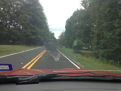
Man, the photo just doesn't do it justice. The thick, black smokescreen looked like something out of James Bond. Every single hill.
He took a left though and I took a right, so I only got to "enjoy" it for a mile or so.
I parked south of the campground in one of the two spots reserved for day use. There are only two spots. Offhand that would seem to under-serve the area, but in the last 15 years, I've never seen either of them occupied, except by myself. And the other spot has never been occupied upon my return.
North of the campground a guy was poking a stick at a timber rattler.
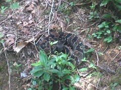
Not sure I'd be poking a stick at it, but it didn't seem too upset about it. No rattle. A far cry from that one I ran into on Tibbs a few weeks back.
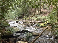
I approached the ford in the creek...
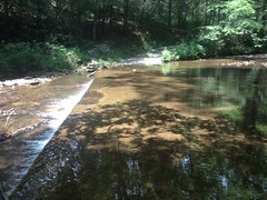
Took in the natural beauty for a minute...
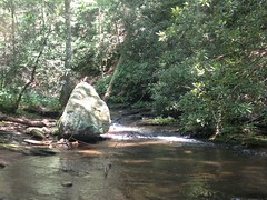
And got down to it.
Years ago I'd been up that way, looking for Low Branch Falls. I'd found a waterfall, but it didn't look much like other photos alleged to be of the same waterfall.
This time I wasn't looking for waterfalls, but from that excursion, I was fairly familiar with the trails in the immediate area. This helped, and I was able to locate the old railbed right away. A little exploration revealed that part of it had at one point been converted to a road and rerouted. There's even a "closed to vehicles" sign back there, but it looks like it's been a very long time since you could have driven up to the sign.
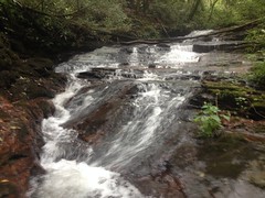
The rail though... It crisscrosses Low Gap Creek twice before ascending up an old overgrown bench cut along England Camp Branch which ends abruptly. There must have been a bridge there at one point because it picks up on the other side, leads directly to this waterfall (which is not on Low Gap Creek, but is the one I think people end up finding and taking photos of)...
And switches back right there.
Past the switchback, the trail appears to get a lot more traffic, though "a lot" is definitely relative. It looked like maybe people boulder hop along the creek and scramble up the falls, rather than following the old rail directly.
The trail was remarkably easy to follow from there on. It looked a lot like the old rail along the Chattahoochee, just a bit more overgrown. There were a few spots with truly difficult deadfall, but it was mostly not-too-bad.
There were two spots where small feeder creeks came in from the left, and there must have been trestles there at some point because the main trail disappears, a small worn-in trail continues, and then the main trail picks back up on the other side.
There was another waterfall along Low Gap Creek itself, above the one I'd originally found way back.
It seemed to be really tall and composed of multiple cascades. Unfortunately I couldn't get too good of a look at the whole thing, just bits and pieces of it.
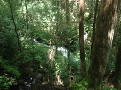
The trail led directly to the top of it though, and there was a decent pool at the upper cascade.
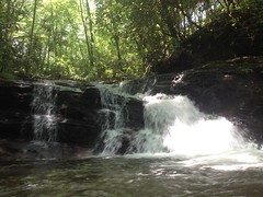
It was in the high 90's at the time, so I took a short swim, and man, was it refreshing. The cascade was only 4 or 5 feet tall too, so I even climbed up on it and jumped off a few times. Ha! Picture that. All by myself, just for fun, nobody to watch me, jumping into the water like a kid. Kathryn was like "Why didn't you take a selfie in front of the falls?" "Because I'm not our 15 year old daughter?" It doesn't occur to me to take photos of myself except when there are cyclists behind me. Maybe I should take a few more though.
At any rate, after playing around a bit, I made my way upstream.
There was another falls further up too.
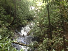
Also quite tall. Didn't look like it had much of a pool at the bottom.
The old rail switched back twice there, presumably to get up over the falls.
The switchbacks were fortified with stacked stone in the same way I'd seen creek crossing fortified before.
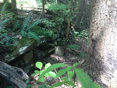
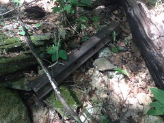
Out at the end of one of the switchbacks there was an old fire ring, and some piece of metal, presumably somehow related to the rail. Maybe some part of the switching mechanism itself.
Not far after that, I found a dead mouse on the side of the trail, being eaten by yellow jackets.
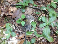
Poor little guy.
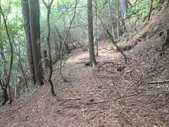
North of that, the trail was quite a bit more wide open than it had been earlier. There were long stretches without deadfall, and very little overgrowth to speak of. It didn't look like the trail got much more traffic there though. Just some quirk of nature kept it clear, I guess.
There was an old spike sticking out of the ground near a creek crossing.

No doubt that once helped hold a trestle together.
And then I found this old moonshine jug.
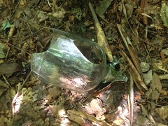
Hey! I'd been there before!
Way back on that first excursion up that way, I'd followed another trail that crossed right there.
At the time, I'd marked on my map that there was a spur leading north. I hadn't seen the one leading south.
The rail crossed the creek and bent north. There were ribbons leading west, but that was definitely not the right way to go.
Half of an old garden hose lay there in the middle of the trail.
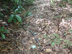
Weird. Was it somehow related to moonshining? If it was, it was from a very long time ago.
Past the garden hose there was a small meadow. It was starting to get taken over by beech trees, but they hadn't filled it in yet.
There was a huge amount of deteriorating black plastic up there though.
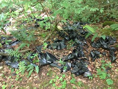
It was riddled with aluminum cans and other garbage, but the plastic didn't look like garbage bags. It was thick. It wasn't that erosion barrier material though. I was honestly stumped. I kept finding it to the north too, like it had originated upstream, and the whole clump had somehow ended up there. Upstream was Wilderness though. There were even signs to that effect posted on trees along the northern edge of the meadow. That just added to the mystery.
Several beech trees had fallen over into the meadow, recovered, and kept on growing.
A piece of plywood had been nailed to a pair of them, making a neat little table.
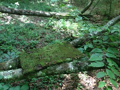
For cleaning fish? I've found several makeshift fish cleaning tables over the years. Who knows though, it could be for anything. Whatever it was for, it hasn't been used in a while.
I pushed on upstream. The rail crossed the creek and resumed on the west side. It kept going and going.
I kept an eye on the time. I had to pick my mom up from my brother's house that evening around 10. It takes an hour to get from my place to my brother's, and it takes two hours to eat and get back to my place from Helen. So, I needed to be out of the woods by 7. It was about 4. I'd gotten started around noon. I had about three hours to get back. On the way up, I'd spent a lot of time poking around and double-checking that I was going the right way. The trip back down really shouldn't take three hours... I gave myself another fifteen minutes.
I'd kind of hoped to either run out of trail or something, but no, it just kept on going, clear as a bell.
There was what appeared to be a switchback on the other side though, so when I did finally turn back, I took that rather than making a direct abort.
Turned out it wasn't a switchback, but just an old road that also led to that beech meadow.
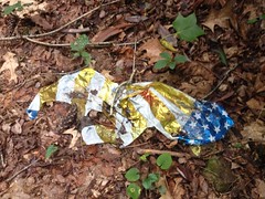
Of course, there was a mylar balloon lying there on that road, as I imagine there is in every square mile of the woods.
I made great time on the way back. The trail seemed more overgrown on the way back than it had on the way out though. I guess it was just because I was moving faster. Funny though, I really noticed it, and I don't usually.
Berries of some kind were growing all over too. I hadn't noticed them on the way up either. I've also seen them in and amongst blueberries on Trail Ridge. I don't know what they are though, so I took a photo so I could do a little research.
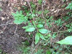
Still haven't done that though. It's been a busy couple of weeks.
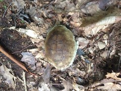
I took a slightly different route out and found this old sunbleached turtle shell on the side of the trail.
And that was about it.
Goodbye Low Gap Creek.
Your mysteries are not yet entirely revealed, but perhaps they will be soon.
I did make it out in time, did make it home in time, and did pick up my mom in time. I then stayed up all night, took her to the airport at 4AM. Talk about a full day. A long, long, full day.
I slept in on Sunday.


No comments:
Post a Comment