Sunday, the fifth of July.
I was supposed to ride Fort Mountain with Eddie and Nam, but by Sunday morning my bike was still trashed, the radar showed rain covering almost every inch of North Georgia and I couldn't seem to get a hold of Eddie by phone or email.
Time for Plan B.
Plan B was to hike the old Cane Creek road and see if it led all the way up to Cane Creek Gap. It might be rough, it may not even go all the way up. No way to be sure without trying though.
I parked just off of FS55 at an odd intersection of old roads, turned garbage dump and shooting range. There were literally hundreds of shotgun shells on the ground, several empty ammo boxes and more shot-up garbage than I've ever seen in one place in my life.
I walked through and around the carnage, over a roadblock and on down the old road. It looked like some strip logging had been done there recently. Luckily, anywhere there's freshly exposed dirt and lots of sunlight, you get...
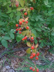
I ate the dark ones.
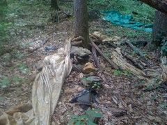
A little further up the road I heard a dribbling sound and discovered this oddity.
I've seen where folks have hammered pipes into hill to get clean water. Here, a hollow log was serving the same purpose. I couldn't tell if it had been hammered in, or if it had fallen over, been cut and naturally became a pipe. Either way, it was cool.
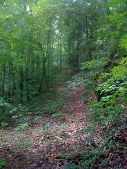
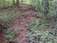
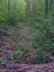
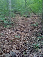
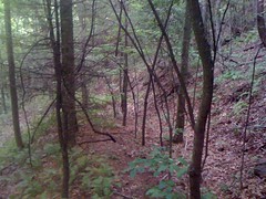
The trail had been kind-of overgrown, but pretty soon it was open and resembled an old roadbed.

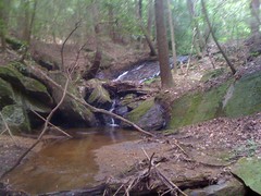
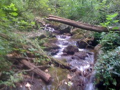
Turninglathe creek flows under, through an old culvert. Below the culvert, was this little sliding falls.
A cottonmouth was hanging out nearby, but as I moved in to take a photo, it retreated up under some rocks. Dangit.
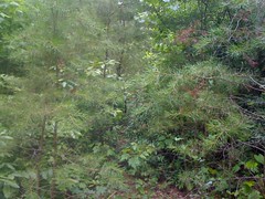
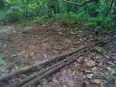
Back on the road, I climbed up and over a little gap and had to push through a good bit of this garbage.
Down the other side, I found an overgrown turn-around with a set of kelley humps on one side. At some point in the past, the official road must have ended here. Beyond the humps, it was narrow and more primitive.
I've seen this kind of thing before:
Sticks have been lain across the trail at an angle and anchored with rocks. I've seen it on Crow Mountain, Old Mulkey Gap Road and I don't remember where else. Some of the ones on Old Mulkey appear to be there as water bars, and are back-filled and over-topped, as tends to happen to water bars. Others are intact and appear to be there to fortify the mounds of the rolling dips. I guess it prevents traffic from eating into the mound. This one was odd because it was the only one on the entire trail, and in a spot that doesn't appear to suffer from high traffic or erosion.
Eventually I reached Cane Creek itself.
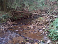
The trail crossed it, crossed back and led up the East Branch. I could tell I was off track but I figured I'd check it out anyway.
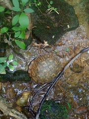
Turtle.
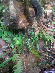
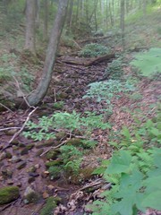
Eventually the trail dead-ended and I went back to look for the real trail. It was on the map, but there was no obvious sign of it. While looking, I found this nice little water feature.
And right up the hill from that I could see the trail. A dense tangle of downed trees had been obscuring it. Back on track, I kept climbing along the east side of the creek until I reached a section of flatts. There, the trail crossed back over and became a "crail". The trail had itself become a creek.
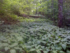
The crail petered out shortly. The map clearly showed the trail continuing, but sometimes when a trail passes through a section of flatts, all trace of it is wiped out by the re-routing of the creek, flooding, erosion, deposition, overgrowth, downed trees, etc. Sometimes flatts are cleared by settlers and used as a field, and a trail will go into one side and out the other but there will be no trace of it in the middle because there was never a distinct trail through the field to begin with.
I figured I'd follow the creek and eventually find the trail on the other side of the flatts.
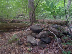
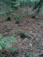
While doing so, I found lots and lots and lots of these rock piles. I've seen these before too. They don't appear to be natural. Are they indian graves?
Hah! My strategy proved successful and I picked up the trail on the other side of the flatts.
Up, up, up.
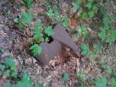
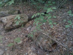
Artifacts galore.
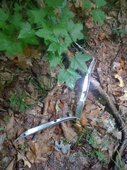
As I rounded a bend, a bright green tarp caught my attention. Interesting.
The trail took a hard right and headed straight uphill.
Eventually it became a sidehill again and crossed a series of feeder creeks before crossing Cane Creek proper once again. There it crossed back and forth over Cane Creek and eventually just became one of the feeder creeks itself. This is the trail.
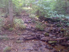
The trail entered, followed, and exited the creek several times before finally entering for good. I walked on rocks up the creek bed as far as possible. I could see Cane Creek Gap ahead of me but there was no trail leading to it and the creek bed ahead was a mess of downed trees.
A few weeks back I'd followed 2 old roadbeds south from Cane Creek Gap. I'd hoped that the trail would just become one of them, but it didn't. It just ended. Those roads must be around here somewhere, though. And lo, uphill to the west, I could clearly one of them. Hah! After a quick bit of bushwhacking I was once again on a clean trail.
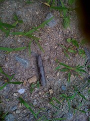
Before long I came upon this little gem:
At first I thought maybe someone had shot it with a shotgun, but note that the holes don't line up and that there is denting on two sides. I think an animal has been chewing on it. Maybe a coyote? Yum, cajun-flavored aluminum.
I recognized this trail.
Success! Cane Creek Gap.
Did I mention that this was the day of one thousand ticks. This was probably the 8th tick I found crawling on me. Over the course of the day, I would find at least that many more.

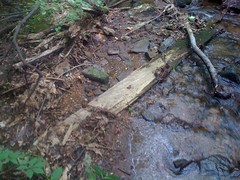
I stacked up a rock, a board and a log and sat down for a snack; half of an Atlanta Bread Company Asiago Strip. Exellent.
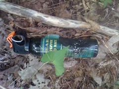
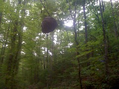
Ranger swag.
Surprisingly, the only other Ranger Swag I'd seen all day was a single, very old, bleached out MRE wrapper.
On the way back, I figured I'd follow the old road rather than bushwhacking down to the creek. Maybe it did join with the Cane Creek Trail and I just missed the intersection.
The road itself ended about 50 feet short of a feeder creek. It didn't appear to have ever gone any further than that. However, back uphill a bit, a spur led steeply down a draw to the Cane Creek Trail.
I wish I had historical maps, or documents, or something. I imagine back in the day, there were homes along Cane Creek. I saw several sites that looked like they'd been levelled and had little spur trails running over to them. The trail may have been a horse, mule or even wagon trail leading down to "town" at the foot of the mountain, where there are still farms and stores today. North of Cane Creek Gap, there's an old road leading down along Blackwell Creek and remnants of a house there. I wonder if whoever lived in that house used to take the trail into town. If so, I guess they'd have followed the creek down to the trail, then take the trail down from there. The roads leading south from Cane Creek Gap appear to have been built much later, for vehicle traffic, most likely logging and don't appear to have been part of the original trail. Who knows, though.
Backtracking was uneventful for a while, but eventually I didn't recognize where I was. I headed back uphill to see what I'd done wrong, and then I saw in the distance: Cane Creek Falls. From where I was standing, it looked massive. How could I have missed it on the way up? Closer in it didn't look so big, but I think that there's more to it up above what this photo shows.
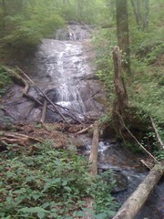
I figured out my mistake. There are 2 trails leading around a little bump near the falls. On the way up I'd taken one, on the way down I'd taken the other. No big deal. It looked like the one I'd taken up was a reroute. The one I took down was deeply trenched and braided.
As I entered the flatts I decided to follow the actual trail and find out exactly where I got off course the first time. It was a bit overgrown, but for the most part it was easy to follow. That said, I did have to climb over the biggest tangle of downed trees, I've ever had the pleasure of climbing over. I swear I was 6 feet up in the air more than once, jumping from trunk to trunk. Looking back, it was obvious why I couldn't discern the trail from the other side. That's it, right there, can you see it?
Down, down, down.
Oh crap!
As I neared the old "end-of-the-road", I remembered that I'd originally followed a rough trail that had T'ed into a pretty clean trail. When I got there I took the clean trail instead of the one I'd come in on. It was well below grade, and led directly up a ridge line, but clearly got more traffic than the bench cut, which would have almost certainly been added later as a re-route. As I pondered this, something caught my attention...
An old cemetery. The graves were unmarked, or the markings had long worn away. I guess folks come this way to see the cemetery, that would make sense. Who's buried here? Justuses, Blackwells, Gaddises, Gooches?
It was, at that time, getting noticably dark. I really needed to get moving. The road bent around and rejoined Old Cane Creek Road near the little gap above Turninglathe. Looks like it had once been a gated forest service road.
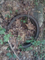
As I crossed Turninglathe, I got curious. To the north was what appeared to be an old campsite, churned up by flooding. There were 4 old tires lying around. The campsite was pretty deep. A large group-camp. And I could hear the distinctly deep sound of falling water. I made my way quickly upstream, and, behold...
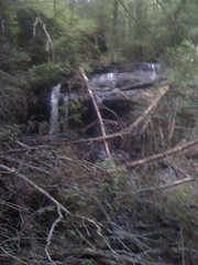
Another waterfall. This photo is no good. It was so dark, I'd have needed a tripod. Those trees are totally in the way too. Darn trees. I had no plans on getting my feet wet though, so it'll have to do.
If it's dark enough to screw up photos, it might be dark enough to get stranded. I double-timed it back out. The way out seemed a lot longer than I remembered. Maybe because it was getting late, maybe because it was all uphill. I started hearing thunder too. It would be awesome if I got caught in the dark and in the rain. No such luck though. I made it back with a bit of light left and rolled on down the mountain. As I turned onto Black Mountain Road, God unleashed His full fury for about 2 minutes. Intense, but unfortunately not even long enough to wash my truck.
It's rare that I have a day like this, maybe one in twenty. Usually I don't find anything and the trail doesn't even go where I wanted it to. Not today. Today was special. Below, I enumerate the blessings:
* The trail mostly went where I wanted it to.
* The trail overgrowth was not miserable.
* I found artifacts everywhere.
* I found 2, arguably 3 waterfalls.
* I found a cemetery! Possibly 2 if those rock piles are indian graves.
* I beat the rain and the dark.
The topo map implies that there are some old settlements back in there. I'll have to come back again and look for those. Thanks Cane Creek, for a good time.


No comments:
Post a Comment