Me and the girlies went back to the east side of Bowman's Island today. I had to bribe them with a trip to Central Park first, but that was fun too. It was odd though. There was almost no one there, I guess because of the heat. It was much cooler in the woods.
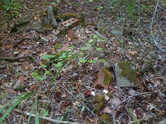
The first thing we did was check out a couple of side trails. The first one led to a brick pile. Old home site, or just where some contractor dumped his junk? Probably the latter.
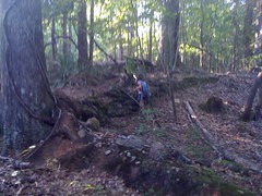
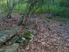
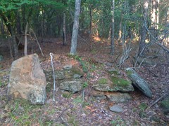
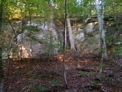
A little trail past the rock wall led to several finds.
The rock wall itself.
Another rock wall.
Chimney ruins?
An old well.

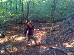
Back to the main trail. Iz was the leader today, and has finally figured out idea of keeping the group together instead of just running off ahead on her own.
River birch.
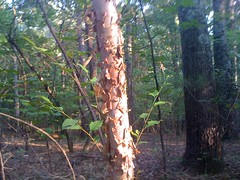
I'm not sure I've ever seen it in the wild before, but my parents planted a couple in our yard when I was a kid.
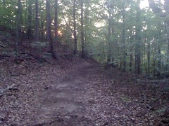
Down the creek trail.

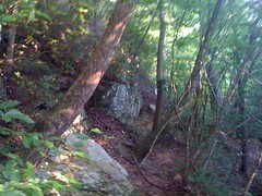
North on the riverside trail, into unexplored territory. The terrain to the west of the riverside trail is rocky.

There's even sort of a cave.
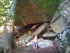
Iz didn't feel like climbing up to the cave.
We'd heard the sirens going off earlier; they were releasing water from the dam. The river was raging. Ordinarily shoals would be visible here.
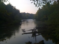
At length we crossed a well-travelled old roadbed. There was a post there with a frame for a map, but no map in it. To the west was the river, and the northern point of Bowman's Island. Several fishermen were out in the river, which was surprising given how high and fast the water was.
I checked the map. To the east was a little neighborhood, the main drag being Island Pointe Road. Maybe this old roadbed would lead to the end of Island Pointe Road. It kind of made sense, seeing as the old roadbed leads to the actual island point. It was getting late, I hadn't seen any side trails leading east since the creek trail, we needed to get back, and the fishermen must have gotten there somehow. We rolled the dice and headed east.
Oooh, crapped out.
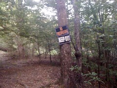
The paved road must be just on the other side of the property but I don't like getting arrested, or shot, so we weren't going that way. It wasn't dark yet, but it was getting darker. If we backtracked, we couldn't make it back around before it got dark. We couldn't go forward and we couldn't go back. Sophie actually figured this out on her own and started to cry. I showed her the GPS though, and the map, and what direction we needed to go, and how it would be pretty much impossible for us not to get there and she calmed down.
We did need to go off-trail though, and she's not a big fan of that. Iz didn't seem to care.
South-south-west.
Pretty quickly I realized that we weren't quite where I thought we were. The trail hadn't led to the neighborhood, but to a property north of it. The neighborhood was directly ahead of us. We skirted around it for a while, but the woods kind of opened up and we could see houses and Island Pointe Road itself. Hmm. Maybe folks wouldn't mind if we cut through between their houses. Actually, it looked like nobody was home in either of the two houses. There were no threatening signs. We went for it. Not the best thing to do, or to teach kids to do, but it was getting late and we really needed to get back.
Hey, sidewalks. We actually walked on the sidewalk almost all the way back to the truck.
Looking at the map now, it looks like there's a trail leading around to Pannell Road from where I got off of the riverside trail. Maybe that's how the fishermen got there. I'll have to go back and check it out.


No comments:
Post a Comment