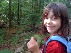
Not a problem though, I have two feet and two little girls who haven't been on a long walk in a long time.
Long Creek.
There are trails up there that I haven't seen, and waterfalls too.
My dad's got my truck so I drove his Crown Victoria up Winding Stair Gap Road. I wondered if it would make it, there are deep washboards and loose gravel at the top. As it turns out, yes, you can make a Crown Victoria climb that road, with relatively little trouble. Nice.
Up 77, down 58, parked at Three Forks.
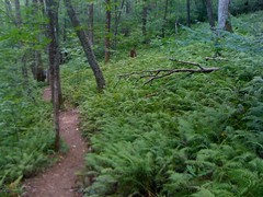
Me and the girlies headed east toward Long Creek Falls.
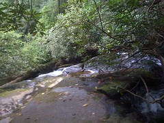
On the way, we made a couple of detours. Long Creek Falls is a well known destination, but there are 2 lesser cascades on the way up to it. I'd seen them from the trail before (in winter they are clearly visible), but I'd never taken the time to get a good look until today.
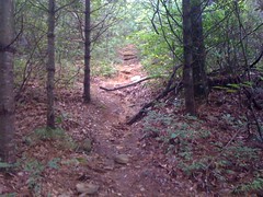
Cascade 1:
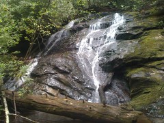

Cascade 2:
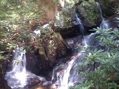
The trails leading to the top of the cascades were pretty clean. The trails leading to the bottom, decidedly less. The girls made it down to the first cascade, but were way less excited about the second and just waited for me to climb down and back up.
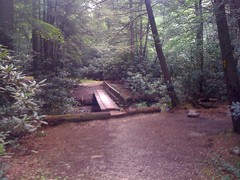
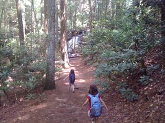
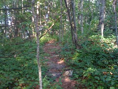
Back on the trail...
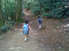
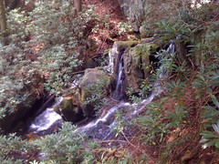
... we headed toward the big one.
Woohoo!!!
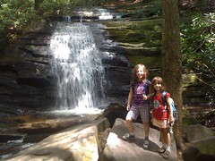
There were some folks camped out there, sleeping in their hammocks. A guy and his golden lab were exploring the area just like us. We talked to him for a while. Nice guy.
I sort of had a plan. Check out the waterfalls here first. Then: Benton MacKaye to FS251B, 251B to 251, No-Name Ridge to the Hawk Mountain Shelter, old Long Creek Road down to 251, old AT back to the real AT, and then back to the car. So far, so good. I felt fine, the girls were looking strong. With a little luck, we could get it done.
Onward...
On the Benton MacKaye, we caught up with a family we'd talked to earlier and they tailed us for a while.
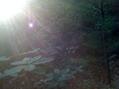
Lush:
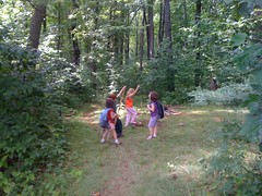
At 251B there's a huge food plot and a nice campsite just beyond. We stopped for a break and chatted for a while. The kids all played together.
As much fun as it was, we had a long way to go.
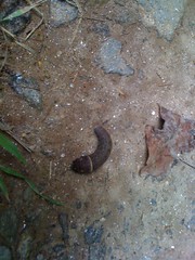
On 251B we found this awesome caterpillar. What is it? What kind of moth does it turn into?
I noticed a trail paralleling 251B down toward the bottom. Darnit, I'll have to come back up and check that out some day.
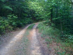
251 proper.
As soon as we turned onto No-Name Ridge we found some ammo. And me without my M-60.
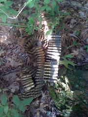
The Rangers drop a lot of trash, but they appear to come back and pick it up later. Mostly at least. I've seen trash strewn out for miles one day, only to come back the next week and find it all gone. We hung up the ammo on a branch nearby at eye level. Hope somebody sees it.
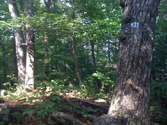
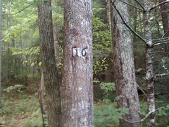
There are 6 humps on No-Name Ridge. The second is labeled for some reason. We'd seen a number 11 earlier too. At the base of Hawk Mountain, it's labeled 59. What do these mean? I have no idea.
We took a little break. I re-guesstimated our timing. If my "calculations" were correct, we were on track and should still have enough time, assuming the sun really goes down at 8:30 and the trails between here and there are passable.

No-name ridge was pretty nice. A little braided, but not too bad. The last time I was here, there was an orienteering marker on this post. Not today.
There was one chunky descent. This is looking back up it.
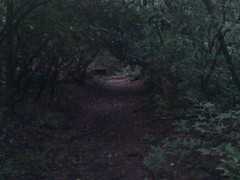
But mostly it was like this.
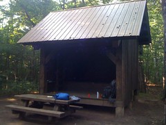
At the Hawk Mountain Shelter, we ran into a guy from Pennsylvania hiking home. He'd apparently forgotten his tent poles. Long story, but it made sense. His wife shipped them to Mountain Crossings at Neel's Gap, but that's days away. He'd been rigging it up with string, but he'd gotten really soaked 2 nights before. Poor guy.
We didn't stay too long. It was getting late. We'd be cutting it close.
If you're at the Hawk Mountain Shelter and you need water, you get it from the upper reaches of Long Creek. The same Long Creek that hosts those falls we were enjoying earlier. The water trail forks off of an old roadbed, which appears to have lead down from the food plot up on Hawk Mountain, in antiquity. I followed it for a few hundred yards one day and it kept going. In my imagination, it leads down to FS251. It my wild imagination, it leads past that and joins up with the AT along lower Long Creek, which is also an old roadbed. But first things first. Today's mission was to get to 251. From there, we'll see.
I'd been letting Iz and Sophie trade off being the leader all day, but for this I thought it best that I go first. Just past the water trail we got into some deadfall, rhodo and young hemlock, but there was a clear path through it. People definitely go this way. The deadfall was amazingly brittle and crumbled into nothing with the slightest touch. The Hemlocks, though. Oh, man. The lower branches get starved for light and just snap off if you push through them, leaving murderous little spikes. Today my girls were following close and I didn't want them getting stabbed. Bull in a china shop.
The old roadbed was easy to follow. It was going exactly where I wanted it to. The overgrowth was manageable. The girls were doing a great job twisting through it. We were making really good progress. But...
At a point, the old road just disappeared. It almost looked like it had been torn up or washed out, or something. There was no roadblock and it didn't look like the road used to just end there. It appeared that I wasn't the only one who'd been confused there. There were tracks in every direction. I milled around in a big circle and, at length, picked up the road again. I have no idea where it went, but we had no time to investigate.
The trail was no longer easy. The overgrowth was dense. Worst of all, we were climbing, which wasn't right. Looking at my compass, we were heading northeast instead of west. Hmmm. Maybe we had gotten off of the main road and onto a spur. Who knows. Before long we were up on the ridge again.
Decision time. I'd seen a trail leading back down off of the ridge earlier. We were right by it now. Should we backtrack on No-Name or take the trail? The trail was very well worn and kind-of went where we needed it to. Even if it didn't, we still had plenty of time to bushwhack to 251 and make it most of the way to 58 before dark. If we stayed on No-Name we'd have a much longer walk in the dark. We took the trail, which led directly down to Long Creek and ended.
Ugh.
We needed to go downstream, so we just walked down the creek itself until we could walk next to it. A few steps off of the creek, it started to look like an actual trail. Yep. A trail. And just uphill we could see the old roadbed again, as overgrown as ever. We stayed on the trail, which basically paralleled the old road. Again we were making good time. Eventually the trail rejoined the road and led out to 251.
Whew.
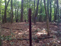
At the intersection, another marker. 10. What does 10 mean?
I checked the clock. We had about 2 miles to go and just under an hour. Doable, but barely. I didn't even look to see if the old roadbed continued along the creek. Instead we trudged westish along 251, and were rewarded with blackberries left and right.
Just short of the Hickory Flatts Cemetery, we picked up the Old AT. Iz led out.
Lovely, dark and deep...
It started out as singletrack. I'm not sure when, but at some point it switched to an old roadbed. Maybe it does hook up with the one we were following earlier. I'll have to come back and look for that someday.
We rejoined the BMK just east of Long Creek Falls, picked up the AT and aimed for home. Darkness came flooding in. The bugs and frogs were really screaming and the girls were starting to get creeped out. I held their hands. We talked and sang and picked up the pace, and made it out while the sky was still technically blue.


No comments:
Post a Comment