This past Sunday was a two-fer. I rode with my dad in the morning, then dropped him off and headed up to Long Mountain for some hikering. It was a quick trip. I had a mission: Long Mountain. There's a trail up on the ridge that the Lumpkin Ridge Trail tees into. Does it lead all the way down to FS243? Only one way to find out.
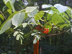
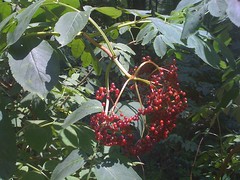
On Horseshoe, I noticed a bunch of elderberries growing on the side of the road. I think they're elderberries. Now that I have a pics, I'll find out.
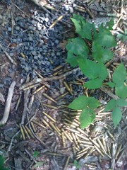
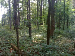
I parked at the bend in FS42 by the big poplar and hiked up to the ridge. It wouldn't be the Blue Ridge WMA without a pile of spent blank rounds.
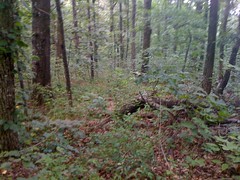
Left... The trail led east along the ridge and up to the top of a little knob. From there though, it became a "trail". In that it was kind-of possible to see where people have gone before, but there was no well worn path.
Down, down, down. The "trail" was easy to see for a while, then it just disappeared. I kept following the ridge, zig-zagging back and forth looking for another trail, but there was no trail to be found. I passed around a cool rock face that I should have taken a picture of. PN was spray painted on the south side of it. PN? Who knows.
At length I did find another trail. And not just a "trail", but a pretty well worn one. It ran through some rhodo and down the west side of the ridge. Before long it started to look like an old skid road or something. But it was going the wrong way and I cut back east to the ridge. It looked like someone else had made the same error recently. I found myself following a line of clear footsteps through the leaves. Back on the ridge, I picked up the trail again and followed it for a while, but eventually it petered out too, near some cool rock formations that looked kind of like coffins. I should have taken a pic of them too. Again I zigzagged down the ridge but there was no trail to pick up. Soon, there was just this:
The worlds biggest field of poison ivy. I could go around, but that would take weeks :) Forget it. I've got better things to do.
Heading back uphill I ran into this, clearly constructed thing. A fire ring?

I picked up the well worn trail and took it as far north as it went, which wasn't very far.
The skid road might go somewhere, maybe over to Two-Run. I followed it down, down, down, but it eventually just ended in a massive jumble of rocks. Hmm. A mystery. Roads usually lead to other roads, but this one did not, on either end. Odd, to be sure.
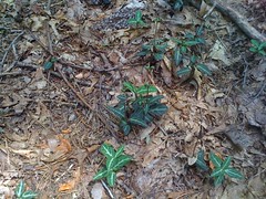
There were a bunch of these things growing on the road. Not trilliums. What are they?
Time to go home. West to Lumpkin Ridge, north to Long Mountain. The climb up to Long Mountain is murder. MURDER. I can't even begin to imagine it with those packs the Rangers wear.
Near the ridge, there was this weird little brush. I saw it the last time I was up here and thought it was a toothbrush. I'm pretty sure it's not now. Kathryn thinks it's a shoe shiner. Maybe it's for cleaning a rifle or something. Maybe it's a shoe shiner. Who knows.
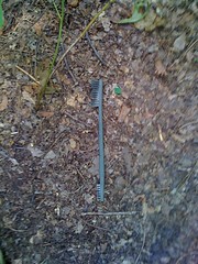
Weird.
What a drag. No long, awesome Long Mountain Ridge Trail. Maybe there's more trail down below though. I'll have to come back in the winter when there's less undergrowth.


No comments:
Post a Comment